Friday, July 27 – Vernal, CO to Salt Lake City, UT
Since our drive to Salt Lake City would be relatively short, we decided to take it easy and have a relaxed start to the day. When every day is full of traveling and activities it can be hard on retired people who normally have a slow paced life. We don’t want our vacation to turn into a big burden.
When we left Vernal the scenery was very beautiful just as it has been every day. At first there were cliffs and canyons with layers of red, gold and light colored rocks. There were also some of those eroded stacked formations in interesting shapes. We did a lot of climbing and descending and also drove along some relatively flat terrain. As we got closer to Salt Lake City we saw several very large reservoirs which seemed a little out of place amidst such dry vegetation. We really love seeing how beautiful our country is. It is so hard to describe the vastness, the diversity, and the awesome beauty in words.
We spent a lot of our driving on interstates today and it is clear why we don’t normally plan our route through big cities. The traffic in the metropolitan Salt Lake City area was brutal and of course this is construction season. I think the lanes out here are narrower than at home. It certainly seems that way when a big truck is barreling along beside us on one side while on the other is a steep drop or a construction barrier…all at 75mph around winding curves! Butch got us through like a champ. I am no good at this kind of driving.
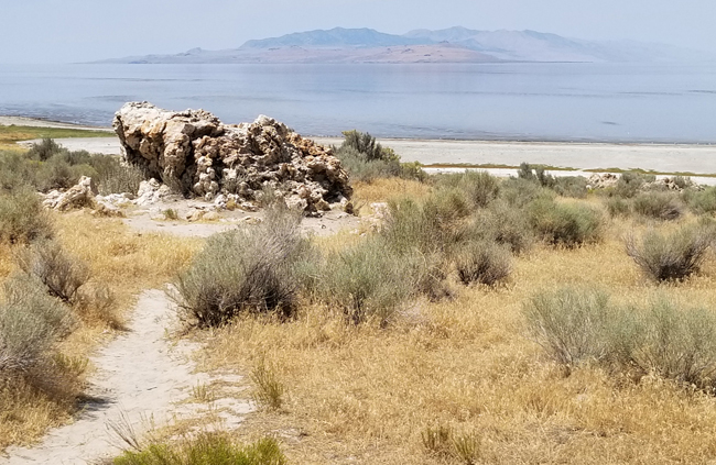
Our main destination today was Antelope Island State Park. Travel sights on the internet said it was the best place to look at the lake since the water level is so low in the summer. It is the largest of 3 islands in the Great Salt Lake and is a wildlife haven. It is named for the pronghorn which has a good sized population on the island. There are also bison, deer, bighorn sheep and coyotes along with many small mammals and lizards. The “keystone species,” a term I learned today, are brine shrimp and brine flies that are found in high concentrations and provide a rich diet for birds, small mammals, and lizards. This allows for the diversity of animals to live on a relatively small island. We did see a herd of bison off in the distance, but not close enough to get a really good look. We also saw lots of birds, and lizards and we were glad we came.
Many people come to hike and there are lots of nice trails. The two of us are not much for strenuous hikes especially in the heat. Today’s high temperature was 104…but of course it is a dry heat! We confined ourselves to scenic overlooks, the visitor center and photo opportunities.
Tonight we went to a Mexican restaurant called Red Iguana. It is highly rated and has a “must try” recommendation. We really enjoyed their interesting menu. I had mango enchiladas which were outstanding.
Butch had a delicious marinated pork dish but when he took a picture it looked like a cow pie so he decided not to post it!
Saturday, July 28 – Salt Lake City, UT to Great Basin National Park and Ely, NV
Today’s drive was a long one. Not far outside of Salt Lake City, we could now see salt deposits along the roadway. The sky was very hazy with almost a blue cast. At breakfast we saw a newscast saying that visibility was poor because of a number of fires in the area. We looked at a Nevada fire map and saw nothing along our route. Any fires were to the north with a couple small ones in the south. It really did not seem like smoke and we couldn’t smell anything but I’m sure they knew what they were talking about.
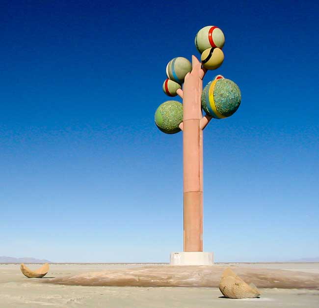
The salt flats looked very white and smooth. Near the road, people had stopped and made messages and pictures in the salt with stones. There were also some sculptures beside the road. One was the head, fins, and tail of a shark sticking out of the salt. Another was like a little Loch Ness monster swimming through the salt. We saw a big sculpture called Monolith: Tree of Utah.
We turned off the interstate and traveled on a two lane and road that seemed like it was in the middle of nowhere. We drove for at least 100 miles without seeing a town or seldom even a house or farm building.Otherwise we spent a very long time driving through a desert landscape covered in scrubby plants and tumble weeds. I have to say that of all the miles we have traveled, this was the least appealing.
When we got to Ely we drove by our hotel and the depot for the train ride we will go on tomorrow. It was too early to check in so we the went to the Great Basin National Park Visitor Center. The displays were interesting and help us understand more about this huge chunk of land that covers most of Nevada. Unfortunately, I was not feeling very well so we skipped the drive to Wheeler Peak and headed back to Ely. We think we are suffering from a little dehydration and altitude sickness. It’s not too bad but it takes the joy out of things.
At one point we passed a wind farm. There were several rows of windmills. Quite a number when you added them all up’
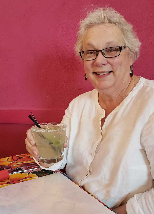
When we went to France a couple of years ago, I took a couple of pictures of people we ran into, almost by chance. They were some of the favorite pictures we took. I decided that I should take people on future vactions. Here is a picture of our waitress at Rack’s Bar and Grill when we had supper that night.
Our hotel here is the worst we have been in. The room itself is clean but most everything else is very old and barely working. The handle on the door is loose so it is hard to make the key work. There were 2 hand towels and 2 washcloths and no bath towels. We decided washing up would be good enough because who knew how the shower would work. Worst of all, the air conditioner could not cool the room. It was in the 80’s when we went to bed and it didn’t really cool down until about 3:30 when it was 50 degrees outside.
Sunday, July 29 – Ely, NV to Lee Vining, CA
We had a difficult night in our motel. The air conditioner was bad and neither of us slept well. On top of that we set an alarm for morning because we had booked a steam train ride for the morning. Instead of waking us at 6:30 Pacific time it woke us at 6:30 Mountain time which was an hour earlier. We were up and almost ready an hour earlier than we had planned. The good news is we had plenty of time for breakfast and packing up the car.
The train ride was called the Nevada Northern.
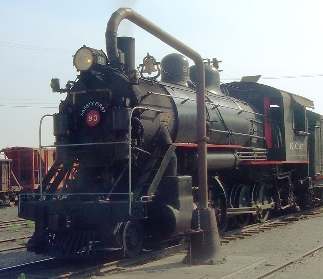
They had an old refurbished steam engine and 1860’s vintage passenger cars. They also had an old flatbed car with benches for those who wanted take pictures. We put on our sun hats and sat outside since it was only in the low 80’s as we started.
As we waited, a soot covered fireman walked by and I asked to to take his picture too.
Karen and Butch on the Steamtrain RideA real steam engine has a lot of black smoke which falls on the viewing car in the form of soot and tiny cinders. We were soon covered but we didn’t mind.
The ride is about 5 miles out and then the same back. There were two tunnels.
They also had a cheesy train robbery and shoot out at a ghost town at the halfway point.
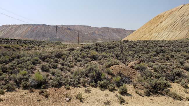
The ghost town was right next to a gigantic open pit copper mine. They piled the tailings so high around it that you couldn’t actually see the mine itself. But you could see the results of their labors.
On the way out we were steadily climbing so that was slower than the way back. The train actually backed into a siding and when they switched tracks we came back with a new view out our side. There were lots of road crossings so lots of steam horn blasts. We both had a great time and Butch got some good pictures.
After gassing up we headed out to Lee Vining, CA which is just outside the east gate into Yosemite. We had hoped to meet up with Wendy, Zach, and the boys on the other side of the park on Monday but as I said earlier, the Ferguson Fire caused the evacuation of Yosemite Valley so we decided as a group to switch gears. We still traveled to the east entrance but planned to go north from there on Monday, around the park and on to the Bay Area.
The drive to Lee Vining was spectacular. We drove the rest of the way across Nevada through grey green scrub without seeing more than 10 buildings the whole way. The road was straight as an arrow most of the time and you could see miles in every direction. The sky remained hazy and smoky all the way. As we drove along we saw a tall tower that was too far away to make out clearly, but the top of it glowed brightly. Hmmmm? We came to a rest stop and while there we saw a number of Joshua Trees which were previously unknown to us. We looked them up in Google Images and took this picture of one. I noticed that the glowing tower was just next to the tree, off to the right a little, just above the horizon. Later I looked the area up on Google maps and discovered that the light was part of the Crescent Dunes Solar Energy Project.
Soon after the California border we turned off on highway 395. The road was smooth and looked like new but it twisted and turned and had hills like a roller coaster. For most of the 60 miles we drove 45 mph or less. Right away the roadsides looked greener and had different plants that had small yellow flowers and bright green foliage. As we climbed there were beautiful rounded dark tan boulders that looked like balls of clay all smooshed together.
The scenery and views were stunning but due to the twisty up and down road there were no overlooks for pictures. It was much too treacherous to pull over.
Lee Vining is a park town with hotels and a couple of restaurants. We checked in…nice room this time…no complaints.
After settling in we went to the Whoa Nellie Deli for dinner. It was a rockin’ place with hundreds of tourists sitting at picnic tables, a live band, and kids running everywhere.
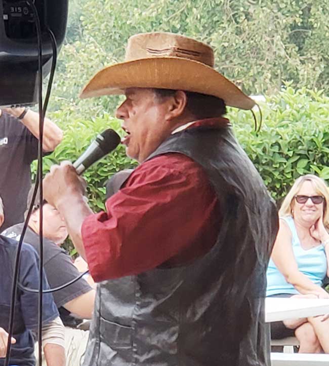
The band was playing all 60’s and 70’s music and lots of white haired oldsters were out dancing and grooving to the music. They trotted out one of the wait staff who did a rocking version of La Bamba.
They also had a gas station and we payed over $4.60 a gallon for gas but we are ready to take off tomorrow.
Monday, July 30 – Lee Vining, CA – El Cerrito, CA
We got up leisurely and decided to take a little trip to see Mono Lake after our waffle breakfast at the Epic Restaurant next door. We went to the Mono Lake visitor center only to find out that it was so smoky you could barely see the shoreline. We started on the route across the park on highway 120. We were so glad we did.
We drove to the ranger station then up into the mountains on Tioga Road. The Tioga Pass is the highest elevation on the road at about 10,000 feet but other mountains towered above us. The views were undisturbed by smoke the farther we went up. I got out of the car several times at overlooks and sidled over as close to the 2 ft. barrier wall as my height phobic mind could bear. I got some great pictures. Every time I got out of the car , the air was filled with the fantastic spicy smell of the plants by the side of the road. I wish I knew what they were. We were worried that we would miss all the beautiful sights in the valley but there were many other fantastic beauties on our route.
First came an area called Tuoloumne Meadows. It was a series of high meadows with a bubbling creek down the middle, sometimes with marshy areas and all the shades of green and gold grasses in the world. It was also dotted with tiny mountain flowers and big glacier boulders dropped there who knows when.
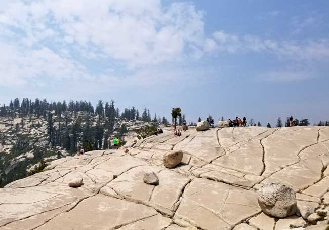
Next stop was Olmstead Point. They had one of those information plaques the showed the peaks in the distance all labeled with their names. The big peaks were visible through the haze but on one end it identified Half Dome which was now totally invisible because of the smoke. At that overlook there were other smaller domes which seemed to be made up of white sparkly granite smoothed by weather and time.
We traveled on along a twisty road, mostly down. Sometimes it was lined with redwoods and sometimes regular pines. There were awesome pine cones from the redwoods lying on the ground. Some were as big a small melons. I dearly wanted to pick one up to bring home but I was sure it was not allowed. I do believe in “Take only pictures…” in our precious parks.
At one point there were clouds of back shapes that seemed to be fluttering all around us. I thought at first they were ashes from the fire which was alarming but it turned out to be butterflies which were hitting the car. I looked them up and found they were Field Crescent Butterflies and we were in the middle of the their main emergence. I hated seeing so many of them hit the cars but apparently that is an unfortunate “thing” for them.
We also went by beautiful lakes with sandy beaches at the edge. Lots of tourists were paddling around in the water. I figured they were probably European because all of the guys were wearing speedos! It was an awesome drive and we were so grateful that we were advised to go that way.
As we got lower and lower in elevation, the smoke began to get thicker. We noticed a little stinging in our eyes but that was all.
As we left the park we saw lots of heavy firefighting equipment and firefighters standing by. I sincerely hope fire does not actually touch this treasure. Just outside we got on another twisty road that was scarier than any road we were on in the park. It was one of those roads that cling to the side of the mountain and as you drive you can see new twists and turns that are coming up below you. They had enormous road signs at every curve announcing 20mph that let you know they were not kidding.
Luckily it smoothed out in Moccasin and we drove toward El Cerrito on the flat. On that road we passed lots of fruit and almond groves along with fruit and nut stands. Soon we were on the Interstate and drove in thick rush hour traffic the rest of the way. At last we arrived and spent a great evening chatting and catching up with the family.












I love that Colorado to Utah part of the country also. I like to see the rock formations. We must have a tone of pictures that all look alike. Loved the picture of the train fireman because he reminded me of Dad. In all our trips I don’t think I have ever seen a Joshua tree either. Cool. When we went to Yosemite we came in from the West over that same pass. We were in a small bus so did not have to drive, just worry about how he would make the turns without plunging us to our deaths. I remember seeing what I thought were small pine trees only to find out they were the tops of giant pine trees. The scenery in the park is awesome and I too am glad fire has stayed out. Guyla told us about terrible storms during Cheyenne Frontier Days so we worried about you with those. Then I thought you were racing fire all the way. Thank fortune you were going around it. This is a fantastic vacation for you guys and thankfully you can take it slow.
We saw threatening clouds as we left Cheyenne but missed any storms. We had to leave from the rodeo because our motel was 2 hours west. Because of Frontier Days, all hotels were fully booked. We saw lots of smoke starting just before Salt Lake City and for the rest of the way to California. I checked each state’s fire map every morning to see if anything was near our route.
Glad you’re enjoying “my” part of the country. I have driven so many of the roads you speak of in my 30+ years of working the NW and No. CA. I’m glad you avoided the fires. We are having a terrible fire season this year with a large number of blazes going on as I write this. I hope you have a great time and a safe trip. I look forward to hearing and seeing the “rest of the story.”
Your part of the country is astoundingly beautiful. Every turn has some view that takes your breath away. I can only imagine the pleasures (and some scariness) of traveling those roads over time.
I love it when you and Karen take a trip because you can make a trip to your local g-store an entertaining event.You make it sound like we should be there with you.Thanks be to God we are not for your sake.Love to hear your travel stories.
I’m glad you enjoy our story. We actually write it mostly for ourselves so we will remember all this stuff! We have had such fun it comes through in the telling. I guess when you look for adventure you find it. I’m sure you and Jeanne would love these sights too!