Sunday August 5 – El Cerrito to Ridgecrest, CA
We took one last set of pictures of us and the boys.
We left Wendy’s at about 11:00. It is always hard to say goodbye knowing it will probably be at least a year before we see them again. We had such a good time just being together let alone doing the fun activities we did.
Wendy says they would like to try a driving trip to Iowa next summer if they can make it work. That would be great and is something to look forward to.
Today we had a drive of nearly 6 hours ahead of us. Our route was on interstate most of the way which is our least favorite kind of drive. The start of it through the Bay Area was through city traffic but because it was Sunday it wasn’t too bad. The rest of the drive was through the central valley so the scenery included lots of nut and fruit orchards and grape vines.
The temperatures climbed and hovered around the 100 degree mark for most of the day. We were trying to eat up miles so only stopped for brief breaks. When we were in Mendocino, Butch tried some chili mango dried fruit for a snack. He tried some more on today’s trip too. Hot and sweet.
Shortly after we left the interstate and left Bakersfield, we entered Sequoia National Forest, which at this end has no Sequoia trees at all. Instead we climbed up these enormous mountains to a pass for crossing. The road followed the Kern River which was a beautiful white water stream cascading over giant boulders.
The mountains at this point were California gold with clumps of green trees and dotted with huge boulders. As we climbed further they became more stark and bare of vegetation but still had huge rocks.
Eventually everything turned into high desert with all kinds of Joshua Trees along the side of the road.
Ridgecrest itself is home to a Naval Weapons Station which covers a huge area of land just west of the town. Amazingly it is not on the crest of a ridge at all. Rather, it is in the middle of the flattest desert pan you would ever want to see.
We checked into our hotel then went to Subways to get a takeout sandwich. We brought it back to our room and settled in for the night. Both of us were pretty tired after the long drive. We hope to get an early start tomorrow because the temperature is going to be at least 108 degrees in Death Valley.
Monday, August 6 – Ridgecrest, CA to Boulder City, NV
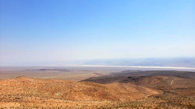
Our Garmin sent us a slightly different way out of Ridgecrest toward Death Valley than we had originally planned. The road rolled away flat and straight for some miles then began to twist and turn and gradually climb. We passed absolutely no one for some miles but after a while one or two cars passed us coming the other way. Finally we started some serious climbing and were obviously heading for a pass over the mountains. We climbed to about 4900 feet and suddenly the view opened up on a vast panorama of nothingness. We pulled over at a pullout where Butch took a picture.
You could see all 180 degrees on front of us over a huge featureless valley that went on forever. It was breathtaking.
While Butch was taking his picture a small bird fluttered at our window like it was trying to get in. Butch tapped on the window to scare it away but as we pulled out it landed on our windshield and grabbed onto the wiper. I thought it would fly away as I started to accelerate but it didn’t. I was afraid I would hurt it so pulled back into the turnout where it hopped off the car. It was obviously confused by something. We came down out of the mountain then turned on the main highway into Death Valley. All the time the temperature climbed from around 100 up to about 114 degrees.
We came to a place where road signs advised us to turn off our air conditioning to avoid overheating as we climbed. We did because we didn’t want to take any chances. It worked and the engine temperature went down though it never got too high. The descent was a 8 1/2 % grade and it was hard not to get going too fast for the road. We passed some playa, some dunes, and the borax works along the road to the Furnace Creek visitors center.
At the visitors’ center they had a temperature gauge reading 120 degrees and 190 ft. below sea level. As always we learned a lot about the history and nature of the valley in the inside displays. Before we went into the Visitor Center the temperature jumped to 121°, but he picture wasn’t good so we used this one.
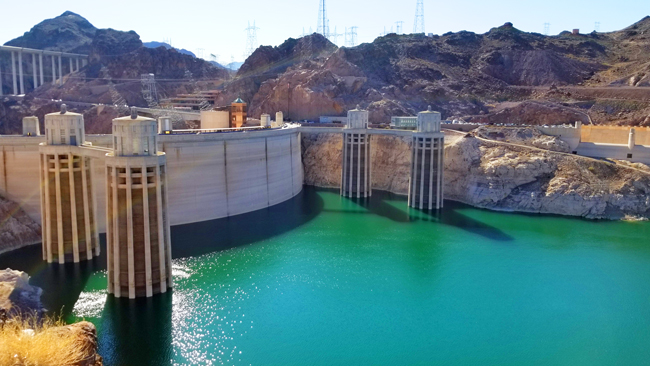
The road out of the park featured lots of mountainous views and interesting rock formations. We headed toward our next stop of Boulder City, NV. We stayed right by the Hoover Dam in Hoover Dam Lodge. We drove over the dam and took some photos at parking areas. 114 degrees is so incredibly hot that we didn’t have the heart or energy for more.
Lake Mead is down quite a bit. You can get an idea how much by looking at the back of the dam. You can see the high water line. It is usually up to the windowy looking parts of the four towers on the upstream side. The dam is incredibly remote and hidden. Not anything like what you are used to seeing. Also, there are a lot of unpleasant twisty road you have to take to get where we went. You can see the bridge in the upper left of this picture. There should be a pretty good shot of the downstream side of the dam from up there but we didn’t go that way. Maybe in the morning?
We checked into our hotel and vowed not to leave again until tomorrow. We had dinner at the cafe there. Not great, but not bad. It was relatively cheap compared to other places we have eaten lately.
Tuesday, August 7 – Boulder City, NV to Tropic, UT
We tried to drive over the bridge at the Hoover Dam so we could take a picture of the down river side of the dam. We drove across the bridge all right but the side rails were too high to take a picture. Oh well, that’s one we missed.
From Boulder City we drove to Las Vegas which turned out to be pretty easy. There was some traffic but it kept moving pretty well and we made it through OK. When we got onto I-15 we started to see soaring mountains and cliffs surrounding our route. I tried to take some pictures from the car but they were not so effective. There were few places to pull over so we had to make do. As we neared a place called Cedar Pocket we began to see a red stream flowing through a valley surrounded by red mesas and striped mountains. Very beautiful.
Driving inside Zion National Park is not allowed except on the highway that goes across the southern part. Tourists use a shuttle system to visit trail heads and scenic view points. We decided to just use the highway and limit our visit to that scenery.The entrance into Zion Park was a little underwhelming compared to all that we had heard.
We stopped at the visitor center which was a hub of activity but was not really as informative as others we have gone to.
However, once we turned onto Highway 89 and drove up toward the tunnel, the landscape turned truly astounding. Red and gold mountains were covered by strange striations that looked as though two mountains ground against each other then one of them disappeared leaving a gouged rock face.
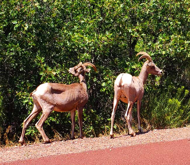
The tunnel provides a road through the mountains for 1.1 miles. It was an amazing engineering feat and was finished in 1930. As we came out of the last tunnel there was a big slow-down and pretty soon we could see that 4 or 5 big horn sheep were grazing by the road…great photo opportunity!
Of all the parks we have been to, these were the first big horn sheep we have seen.
It is amazing that the scenery at Zion goes from magnificent to rather mundane as soon as you pass out of the gates. Bryce Canyon is about 60 miles away from Zion. But Bryce Canyon scenery seems to start about 10 miles away when you drive through Dixie National Forest.
We even began to see some of the rock formations called hoodoos that the park is famous for.
As usual one of our first stops was the visitor center which again was very busy but in this case had a large exhibit area with lots of information about the unique geology, plants, animals, and human history of the area. We drove the scenic road in the park and stopped at overlooks and took lots of pictures.
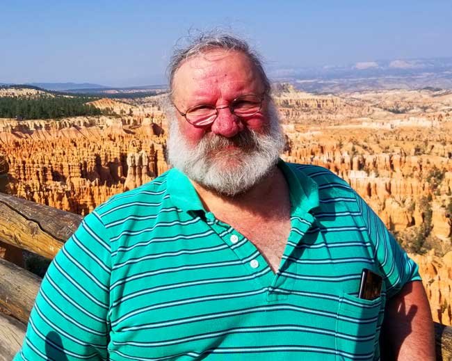
Our favorite was Inspiration Point that had a majestic view of the Bryce Amphitheater which is a panorama of red and orange hoodoos and far and near cliffs and mountains. Our country is so beautiful.
Tropic is a small town not far from the canyon. It is a touristy place with not much more than a few hotels, a gas station, and a couple of restaurants. But who needs anything more?
Wednesday, August 8 – Tropic, UT to Montrose, CO
Today was a banner day. We started out toward Capitol Reef National Park. Our Garmin had plotted a different course than the one Butch had planned. We noticed that the new course went through Escalante so we went with it.
We frequently marvel at how the landscape changes dramatically in hardly any distance at all. At times, one side of the road is all red rocks and the other is black and white layers. It is always amazing.
Escalante Grand Staircase National Monument came up first on our route. Signs at the first overlook said that this area was the “most wild, the last mapped, and the least roaded” area in the country. The overlook showed us a vast panorama of colored cliffs, pinnacles and eroded domes. Down below we could see one road winding its way through the view.
From there we traveled through a deep canyon of red layered rocks then began to climb again. We ended up on one of the scariest roads we have driven on this trip. The road itself was new and in excellent shape but it followed the contours of a very high ridge that meandered and curved. It was just wide enough for two cars and on either side was a sharp drop off, in some cases, over 1000 feet. There were rarely any rails on the side. It was totally white knuckle driving all the way. At one point we saw a road cutting off the main road named Hell’s Backbone and we wondered how it could possibly be worse than the one we were on. Finally we came down off the top and continued on to Capitol Reef National Park.
This is a small park and less well known but just as astounding as the others we have seen. The park is named from accounts by early settlers. It seems that many groups of travelers included former sailors who called any obstacles difficult to get over or around, a reef. They also thought the white domed rocks looked like the dome on the Capitol building.
At the visitor center Karen saw a collection of tiny cactus plants. For scale, the largest one of these is about 3″ tall.
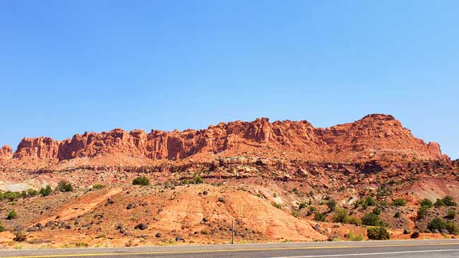
The reef is a 100 mile long geologic formation called a water pocket fold. It was an amazing park with towering red cliffs right next to the road that was built down the center of a narrow canyon. The sides of the walls were eroded by water into amazing holes and tunnels in the softer rocks.
After Capitol Reef we drove the rest of the way to Montrose, CO on the interstate which was a welcome relief from the scary roads of earlier. When we got to town we stopped at the visitor center to ask about night stargazing in dark country. The woman there advised us to go to Black Canyon of the Gunnison National Park tonight rather than tomorrow as we had planned. The Rangers and a local club were giving an astronomy lecture that very night in the camp ground. We checked into our hotel and headed to the park.
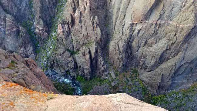
Black Canyon is narrow and deep. The sides are mostly made up of black rocks and the canyon is so deep and narrow that the sun rarely lights up the bottom. There is a scenic drive that hugs the rim and there are many overlooks that provide views down into the canyon. The first overlook we went to gave us the heebee jeebies! The view was straight down and was totally dizzying. We held our camera out at arm’s length and took a few photos.
The drive along the rest of the rim was a lot like our scary experience earlier in the day. We stopped a few more times and decided we were too chicken for any more. The thought of driving back on this road in the dark was even worse so we decided to use our good sense and abandon our plans. We drove back down before the sun went down and went to dinner instead.
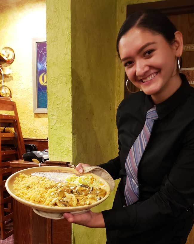
Karen was getting tired of Mexican Food but it is one of the most easily available things to get and generally of pretty good quality. We went to the Family Mexican Restaurant and had one of the best Mexican dinners of the trip. Karen had Chicken Mole that had chocolate, apples, raisins and cinnamon in the sauce and I had Chipotle Cream Chicken (shown above).












Another amazing segment. All of this is places I have never seen. Very cool.
Wow! One of the most wonderful and most memorable travels that I have ever read. The trip such as this was always in our minds for adventuring and exploring. Travel safe back home.
Thanks Daniel. Ying talked to me about your travel plans and the RV life that you guys wanted to try. I know you would have had adventures too. It makes me realize how precious life is and how important it is to live it to the fullest while we can. Butch and I were lucky to have had this experience together. Take care!