2018 California Vacation – Part 5

Thursday, August 9 – Montrose, CO to Lamar, CO

Today we just drove. We visited Black Canyon of the Gunnison last night which was our plan for today. We were so scared by the scenic drive and the overlooks so close to the edge of the canyon that we did not have the courage or the heart to go back this morning.

We slept in late which helped us a lot. We have had such fun that the rigors of this much travel hadn’t really bothered us but now it seems to be catching up with us. We were hoping that today’s drive would not be too bad because we knew that we would be driving out of the Rockies and into more of the high plains.

Colorado is so decidedly different from Utah. Both have mountains and majestic views but Colorado is green, and trees and grass are back in the landscape. It is a bit restful after all the golds, reds, and purples and harsh peaks of Utah. We still had some tricky driving though the road was very good and there were often 3 lanes with the extra for slower cars on the climbing side. Still, these Iowa drivers took sharp curves and switchbacks more slowly than some others on the road. We often pulled over for them to pass.

We were relieved when we reached Canyon City with interstate driving and flatter terrain. [Butch here, now we are safe and sound on flat land again, I have to say that I REALLY, REALLY HATE driving in the mountains. I did practically all the driving and the twisty up and down mountain roads with hairpin turns, switchbacks and shear drops had a terrifying and extremely fatiguing effect on me. The thing I hated the most was a sharp left-hand turn on a 8% downhill plummet with the mountain on the left. One lapse in concentration could have you pulling a Thelma and Louise with a 1000 foot drop.] Lamar is a typical small Colorado town. I did a Google Maps search for attractions and really only came up with a statue of the Modonna of the Trail. So you will have a picture to look at, here she is.

Madonna of the Trail

We found a Thai restaurant for dinner. I loved the fresh vegetables but Butch hadn’t missed them at all. We looked out the window while we were eating and noticed the Lamar Amtrak Railroad Station. We took a trip on the California Zephyr a few years ago, but it went through Denver. I wonder what route goes through Lamar.

Lamar, CO Amtrak Station

Friday, August 10 – Lamar, CO to Wichita, KS

We had a drive of about 5 1/2 hours today and was a piece of cake compared to mountain driving. We crossed the border into western Kansas and things started looking more like home. One difference is huge cattle lots along the highway with hundreds of cattle in multiple pens. It looks like this is where US beef comes from!

We passed the driving time with a book on tape. Today we were listening to a Virgil Flowers book by John Sanford. We thought about stopping in Dodge City but pretty much all of the attractions there are connected up into the Boot Hill Museum which looked pretty cheesy overall with fake gunfights etc. We decided to give it a pass.

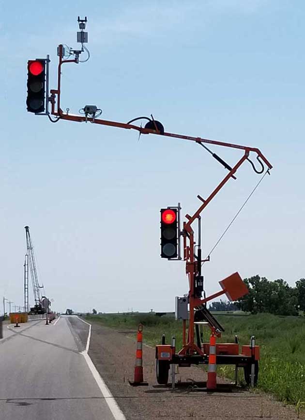
We were slowed down on the road at one point where only one lane traffic was allowed. We saw this really strange traffic light contraption that deserved to be recorded in our blog. I wonder what one of those costs.

Strange traffic Light Thingy

We found a Frank Lloyd Wright House near our hotel in Wichita so decided to take a look. It was the Allan Lambe house and was one of the last Prairie  Style houses he designed. It is a style we particularly like but we arrived after closing time and only got to see the outside.

Frank Lloyd Wright Home in Wichita

It is clear that our travels are winding down. We checked into our hotel and ordered a pizza. We had been hankering for one for several days now.

Saturday, August 11 – Wichita, KS to HOME!!!

We were pretty eager to get on the road so we left an hour earlier than we planned. Butch drove virtually the whole way to California and back as far as Wichita. It was definitely time for him to have a break. Our hotel was right next to the interstate so we thought it would be easy to get on our way. Unfortunately, there was a huge rebuilding project going on and we made several wrong turns and finally followed some crazy directions from our Garmin to get going the right way. Since we had to drive on streets parallel to the interstate, she thought we were already on it. Her directions were contradictory and confusing.

When we finally got underway we tuned into our audio book, another Virgil Flowers book by John Sanford. Then it was just drive, drive, drive for hours and hours. Kansas looks more like Nebraska than Iowa so it still didn’t feel like home. At Kansas City we turned north on I 35 toward Des Moines and then it did. It was great to see rolling fields of corn and soy beans and lots of green.

We drove for almost 8 hours which was our longest on the whole trip. We arrived home and started the job of unpacking and doing lots of laundry. The big payoff was sleeping in our own bed.

This was our longest road trip and overall we did well. We had lots of fun, only got a little cranky with each other a couple of times. We  saw amazing sights, so many that they almost became commonplace. We are creakier physically as the years go by but we usually only drove about 5 hours in a day which was manageable. It was an amazing experience and we have lots of pictures to help us remember.

Butch here. In some ways, this vacation was an experiment. Our last 3 big vacations were all US roadtrips. The one to Washington DC was 10 days long. The one to Yellowstone was 12 days long and the one to the Grand Canyon was also 12 days. We have also had several shorter road trips of a week or less. This trip was for 20 days. It was sort of a test of our endurance. We thought the earlier road trips might not have been long enough. This trip was definitely a little too long. We like these roadtrips because we can drive right up and only have to walk a short distance to what we want to see. This is an important consideration since our various joints have started to become undependable. We would still like to travel internationally but having public transportation near our accommodations and the sights we want to see would be an absolute necessity. We were able to make that happen when we went to France and Holland. Both of those vacations also had a roadtrip experience. A roadtrip in England is not so far fetched. My aunts and cousins all live outside London which I have seen many times before. We would also like to have another train journey. The Empire Builder route from Chicago to Seattle is one we have our eye on. We would need to do some very careful planning for that because of Amtrak’s peculiar pricing policies. Given all that, you are probably not off the hook for reading these blogs for a while yet.


Posted in Autobiography, Daily life | 6 Comments

2018 California Vacation – Part 4

Sunday August 5 – El Cerrito to Ridgecrest, CA

We took one last set of pictures of us and the boys.

Karen and Butch with Augie and Wyatt

We left Wendy’s at about 11:00. It is always hard to say goodbye knowing it will probably be at least a year before we see them again. We had such a good time just being together let alone doing the fun activities we did.

Ready to Depart – Robert and Karen Thorpe

Wendy says they would like to try a driving trip to Iowa next summer if they can make it work. That would be great and is something to look forward to.

Today we had a drive of nearly 6 hours ahead of us. Our route was on interstate most of the way which is our least favorite kind of drive. The start of it through the Bay Area was through city traffic but because it was Sunday it wasn’t too bad. The rest of the drive was through the central valley so the scenery included lots of nut and fruit orchards and grape vines.

Nut Trees of some Sort

The temperatures climbed and hovered around the 100 degree mark for most of the day. We were trying to eat up miles so only stopped for brief breaks. When we were in Mendocino, Butch tried some chili mango dried fruit for a snack. He tried some more on today’s trip too. Hot and sweet.

Shortly after we left the interstate and left Bakersfield, we entered Sequoia National Forest, which at this end has no Sequoia trees at all. Instead we climbed up these enormous mountains to a pass for crossing. The road followed the Kern River which was a beautiful white water stream cascading over giant boulders.

Kern River Canyon

The mountains at this point were California gold with clumps of green trees and dotted with huge boulders. As we climbed further they became more stark and bare of vegetation but still had huge rocks.

Mountainous Rock Formations

Eventually everything turned into high desert with all kinds of Joshua Trees along the side of the road.

Joshua Trees

Ridgecrest itself is home to a Naval Weapons Station which covers a huge area of land just west of the town. Amazingly it is not on the crest of a ridge at all. Rather, it is in the middle of the flattest desert pan you would ever want to see.

We checked into our hotel then went to Subways to get a takeout sandwich. We brought it back to our room and settled in for the night. Both of us were pretty tired after the long drive. We hope to get an early start tomorrow because the temperature is going to be at least 108 degrees in Death Valley.

Monday, August 6 – Ridgecrest, CA to Boulder City, NV

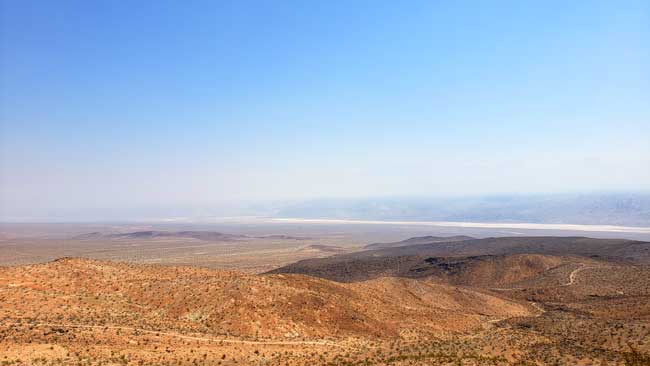
Our Garmin sent us a slightly different way out of Ridgecrest toward Death Valley than we had originally planned. The road rolled away flat and straight for some miles then began to twist and turn and gradually climb. We passed absolutely no one for some miles but after a while one or two cars passed us coming the other way. Finally we started some serious climbing and were obviously heading for a pass over the mountains. We climbed to about 4900 feet and suddenly the view opened up on a vast panorama of nothingness. We pulled over at a pullout where Butch took a picture.

The Desolation of Death Valley

You could see all 180 degrees on front of us over a huge featureless valley that went on forever. It was breathtaking.

While Butch was taking his picture a small bird fluttered at our window like it was trying to get in. Butch tapped on the window to scare it away but as we pulled out it landed on our windshield and grabbed onto the wiper. I thought it would fly away as I started to accelerate but it didn’t. I was afraid I would hurt it so pulled back into the turnout where it hopped off the car. It was obviously confused by something. We came down out of the mountain then turned on the main highway into Death Valley. All the time the temperature climbed from around 100 up to about 114 degrees.

We came to a place where road signs advised us to turn off our air conditioning to avoid overheating as we climbed. We did because we didn’t want to take any chances. It worked and the engine temperature went down though it never got too high. The descent was a 8 1/2 % grade and it was hard not to get going too fast for the road. We passed some playa, some dunes, and the borax works along the road to the Furnace Creek visitors center.

Sand Dunes in Death Valley

20 Mule Team Borax Mining Facility

At the visitors’ center they had a temperature gauge reading 120 degrees and 190 ft. below sea level. As always we learned a lot about the history and nature of the valley in the inside displays. Before we went into the Visitor Center the temperature jumped to 121°, but he picture wasn’t good so we used this one.

High Temperature at Furnace Creek, Death Valley

The road out of the park featured lots of mountainous views and interesting rock formations. We headed toward our next stop of Boulder City, NV. We stayed right by the Hoover Dam in Hoover Dam Lodge. We drove over the dam and took some photos at parking areas. 114 degrees is so incredibly hot that we didn’t have the heart or energy for more.

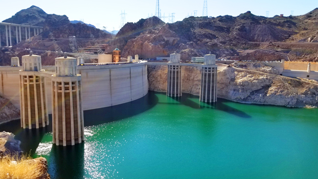
Upstream Side of Hoover Dam

Lake Mead is down quite a bit. You can get an idea how much by looking at the back of the dam. You can see the high water line. It is usually up to the windowy looking parts of the four towers on the upstream side. The dam is incredibly remote and hidden. Not anything like what you are used to seeing. Also, there are a lot of unpleasant twisty road you have to take to get where we went. You can see the bridge in the upper left of this picture. There should be a pretty good shot of the downstream side of the dam from up there but we didn’t go that way. Maybe in the morning?

We checked into our hotel and vowed not to leave again until tomorrow. We had dinner at the cafe there. Not great, but not bad. It was relatively cheap compared to other places we have eaten lately.

Tuesday, August 7 – Boulder City, NV to Tropic, UT

We tried to drive over the bridge at the Hoover Dam so we could take a picture of the down river side of the dam. We drove across the bridge all right but the side rails were too high to take a picture. Oh well, that’s one we missed.

From Boulder City we drove to Las Vegas which turned out to be pretty easy. There was some traffic but it kept moving pretty well and we made it through OK. When we got onto I-15  we started to see soaring mountains and cliffs surrounding our route. I tried to take some pictures from the car but they were not so effective. There were few places to pull over so we had to make do. As we neared a place called Cedar Pocket we began to see a red stream flowing through a valley surrounded by red mesas and striped mountains. Very beautiful.

Cedar Pocket

Driving inside Zion National Park is not allowed except on the highway that goes across the southern part. Tourists use a shuttle system to visit trail heads and scenic view points. We decided to just use the highway and limit our visit to that scenery.The entrance into Zion Park was a little underwhelming compared to all that we had heard.

We stopped at the visitor center which was a hub of activity but was not really as informative as others we have gone to.

Visitor Center at Zion

However, once we turned onto Highway 89 and drove up toward the tunnel, the landscape turned truly astounding. Red and gold mountains were covered by strange striations that looked as though two mountains ground against each other then one of them disappeared leaving a gouged rock face.

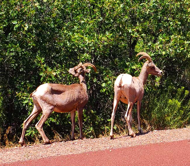
The tunnel provides a road through the mountains for 1.1 miles. It was an amazing engineering feat and was finished in 1930. As we came out of the last tunnel there was a big slow-down and pretty soon we could see that 4 or 5 big horn sheep were grazing by the road…great photo opportunity!

Big Horn Sheep

Of all the parks we have been to, these were the first big horn sheep we have seen.

It is amazing that the scenery at Zion goes from magnificent to rather mundane as soon as you pass out of the gates. Bryce Canyon is about 60 miles away from Zion. But Bryce Canyon scenery seems to start about 10 miles away when you drive through Dixie National Forest.

Dixie National Forest

We even began to see some of the rock formations called hoodoos that the park is famous for.

Hoodoos entering Bryce Canyon

As usual one of our first stops was the visitor center which again was very busy but in this case had a large exhibit area with lots of information about the unique geology, plants, animals, and human history of the area. We drove the scenic road in the park and stopped at overlooks and took lots of pictures.

Bryce Canyon, Inspiration Point

Our favorite was Inspiration Point that had a majestic view of the Bryce Amphitheater which is a panorama of red and orange hoodoos and far and near cliffs and mountains. Our country is so beautiful.

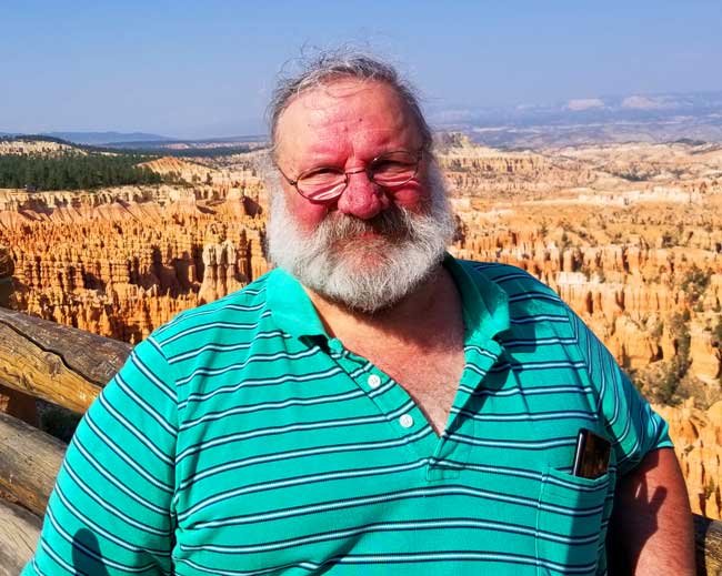
Butch at Inspiration Point

Tropic is a small town not far from the canyon. It is a touristy place with not much more than a few hotels, a gas station, and a couple of restaurants. But who needs anything more?

Wednesday, August 8 – Tropic, UT to Montrose, CO

Today was a banner day. We started out toward Capitol Reef National Park. Our Garmin had plotted a different course than the one Butch had planned. We noticed that the new course went through Escalante so we went with it.

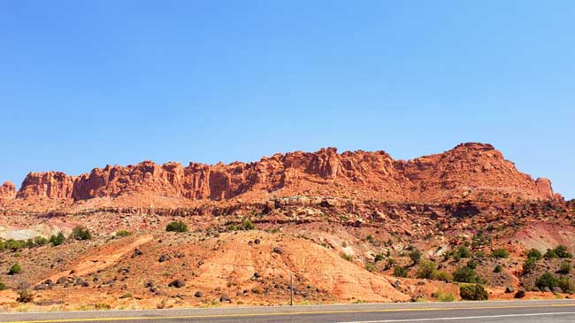
We frequently marvel at how the landscape changes dramatically in hardly any distance at all. At times, one side of the road is all red rocks and the other is black and white layers. It is always amazing.

Karen

Escalante Grand Staircase National Monument came up first on our route. Signs at the first overlook said that this area was the “most wild, the last mapped, and the least roaded” area in the country. The overlook showed us a vast panorama of colored cliffs, pinnacles and eroded domes. Down below we could see one road winding its way through the view.

Switchback Road at Escalante

From there we traveled through a deep canyon of red layered rocks then began to climb again. We ended up on one of the scariest roads we have driven on this trip. The road itself was new and in excellent shape but it followed the contours of a very high ridge that meandered and curved. It was just wide enough for two cars and on either side was a sharp drop off, in some cases, over 1000 feet. There were rarely any rails on the side. It was totally white knuckle driving all the way. At one point we saw a road cutting off the main road named Hell’s Backbone and we wondered how it could possibly be worse than the one we were on. Finally we came down off the top and continued on to Capitol Reef National Park.

Capitol Reef

This is a small park and less well known but just as astounding as the others we have seen. The park is named from accounts by early settlers. It seems that many groups of travelers included former sailors who called any obstacles difficult to get over or around, a reef. They also thought the white domed rocks looked like the dome on the Capitol building.

Teeny Cacti

At the visitor center Karen saw a collection of tiny cactus plants. For scale, the largest one of these is about 3″ tall.

The reef is a 100 mile long geologic formation called a water pocket fold. It was an amazing park with towering red cliffs right next to the road that was built down the center of a narrow canyon. The sides of the walls were eroded by water into amazing holes and tunnels in the softer rocks.

Majestic Pinnicle

Mountain Castle

After Capitol Reef we drove the rest of the way to Montrose, CO on the interstate which was a welcome relief from the scary roads of earlier. When we got to town we stopped at the visitor center to ask about night stargazing in dark country. The woman there advised us to go to Black Canyon of the Gunnison National Park tonight rather than tomorrow as we had planned. The Rangers and a local club were giving an astronomy lecture that very night in the camp ground. We checked into our hotel and headed to the park.

Black Canyon of the Gunnison

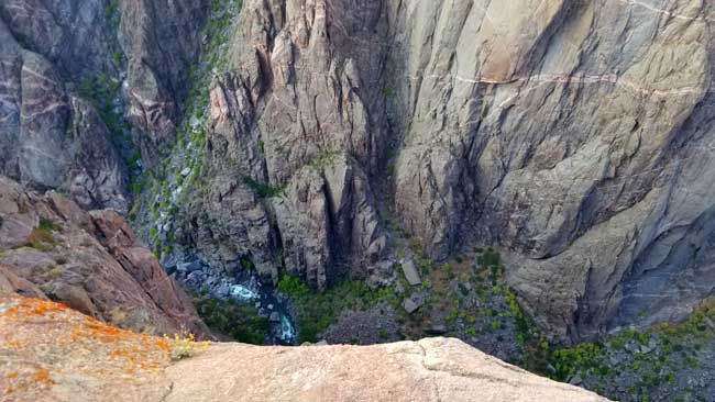
Black Canyon is narrow and deep. The sides are mostly made up of black rocks and the canyon is so deep and narrow that the sun rarely lights up the bottom. There is a scenic drive that hugs the rim and there are many overlooks that provide views down into the canyon. The first overlook we went to gave us the heebee jeebies! The view was straight down and was totally dizzying. We held our camera out at arm’s length and took a few photos.

Black Canyon of the Gunnison

The drive along the rest of the rim was a lot like our scary experience earlier in the day. We stopped a few more times and decided we were too chicken for any more. The thought of driving back on this road in the dark was even worse so we decided to use our good sense and abandon our plans. We drove back down before the sun went down and went to dinner instead.

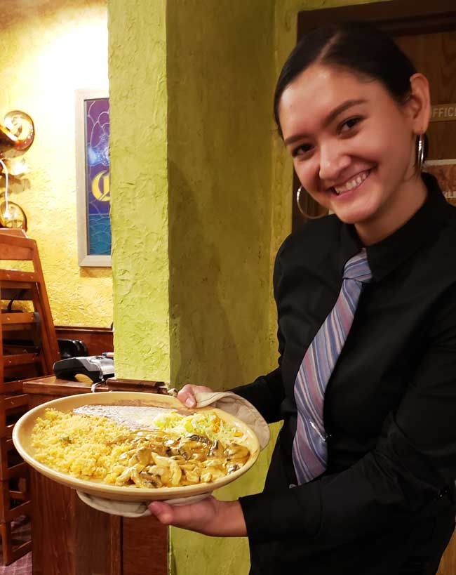
Waitress at Family Mexican Restaurant

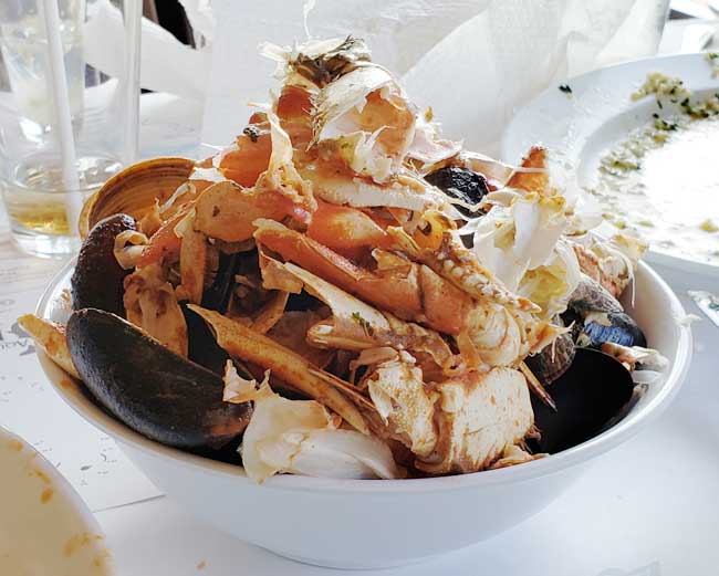
Karen was getting tired of Mexican Food but it is one of the most easily available things to get and generally of pretty good quality. We went to the Family Mexican Restaurant and had one of the best Mexican dinners of the trip. Karen had Chicken Mole that had chocolate, apples, raisins and cinnamon in the sauce and I had Chipotle Cream Chicken (shown above).

Posted in Autobiography, Daily life | 3 Comments

2018 California Vacation – Part 3

Tuesday, July 31 – El Cerrito

When we arrived last night, we had a wonderful reunion.

The Copleys

We stayed up late talking and catching up so it was wonderful to sleep in and know that we didn’t have to pack up and get on the move. So good to drink coffee and chat with our girl this morning.

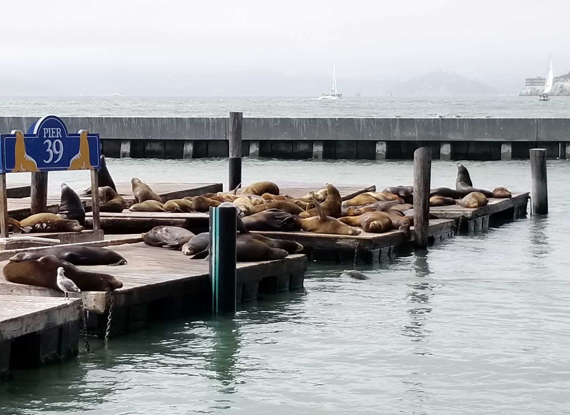
Our activity for today was a trip into San Francisco and Fisherman’s Wharf. While waiting for the main activity we had a chance to look around the wharf and see the Sea Lions.

Sealions at Pier 39 in San Francisco

There was a boat ride out on the bay that we hadn’t tried before. It was called the RocketBoat.

The Rocket Boat

It was a big speed boat with a powerful engine and they took us out on the bay to race around in big circles. It was a complete thrill ride.

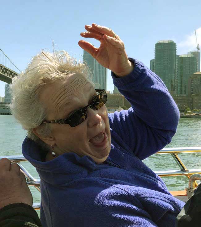
Wyatt and I sat on the edge nearest the railing and when they turned the boat in a tight circle it sprayed us with sea water. The whole time we were laughing out loud because it was so crazy.

Karen in the Rocket Boat

The wind was whipping in our faces and it was cold out there but nobody cared. When we got to land, we got out and sat down to catch our breath. Wendy got some great pictures during the ride.

Augie in the Rocket Boat

Next we went to a seafood restaurant on Pier 39 called Fog Harbor. We all had fantastic meals while looking out toward the pier.

Wyatt Getting Ready to Chow Down

Butch and Karen’s Seafood Feast

The Remains of the Seafood Feast

After the restaurant we bought Carmel corn and cotton candy for the boys before leaving.

On our way home we chose a route across the Golden Gate Bridge which was partly shrouded in fog.

Golden Gate Bridge in Fog

Wednesday, August 1 – Mendocino

About a week before we left on our trip, the situation around Yosemite turned bad. Not only was the Ferguson Fire threatening the south and west  entrances, they closed Yosemite Valley because of the air quality and to keep the roads open for fire fighting equipment. Then there was a rock slide on the northern Tioga Pass Road. Apparently some cars on the road were actually hit by falling rocks and the road was closed for clearing for a day or so. We decided to cancel our reservation and give up on meeting Wendy’s family there. Instead, Zach’s sister and brother-in-law offered to let us stay at their vacation house in Mendocino for a few days. Mendocino is a little village north of the Bay Area right on the ocean.

Erin and Bryan’s House in Mendicino

We had a relatively boring drive on the interstate for about half the way then turned onto a very twisty and hilly road. Zach had volunteered to be the driver like a sweetheart. The road passed through dense woods of redwood trees. At times it was so dark it was hard to see.

After we arrived and settled in we set off for the kids’ favorite restaurant, Sea Pals. You order your fish/shrimp dinner then find a table on the dock. They bring your food out to you. While we ate we saw some sea lions swimming in the channel.

Prawns and Fries with Red Beer

It is a working fishing dock with lots of boats bringing in fresh catch and ready to be hired by tourists who want to fish.

Augie

Wyatt

When we got back to Erin and Bryan’s, Zach and Wyatt got into the hot tub for a soak.

Thursday, August 2 – Mendocino

There is a lot of inertia to overcome to get the various members of this crew out the door. While we waited, Wendy and I took a few minutes to walk around the property to look at what is growing here. As I said before, we are staying at Zach’s sister and brother-in-law’s vacation house. They have refurbished the house and have planted some new things. Out front they have stunning flowers called Red Hot Pokers that I love.

Red Hot Pokers (Kniphofia) at Erin and Bryan’s

We also found pear trees, apple trees, artichokes and some new plants we couldn’t identify.

Artichoke

We went to the back of their lot and found a big redwood, holly plants, and some red nasturtiums that looked like they were growing wild. Scattered across the lawn were all sorts of tiny pink and yellow flowers in amongst the golden grass. It is a very pretty effect.

We were ready to go at about noon and went to the train station to buy tickets for our second train ride of the vacation, the Skunk Train.

Skunk Train Engine

It was called that, not because it smelled like a skunk exactly, but because when it first started, the combination of oil and gasoline smelled bad to those living along the tracks who could smell it before they saw it… just like a skunk.

Skunk Train

The ride was about an hour long and went through the woods along a nice stream where redwoods, several different ferns, skunk cabbages, blackberries, and lots of other things we didn’t know the names of were growing. It was a nice way to get up close to the kind of woods we drove through on our way here.

This Way to the Sin Hole

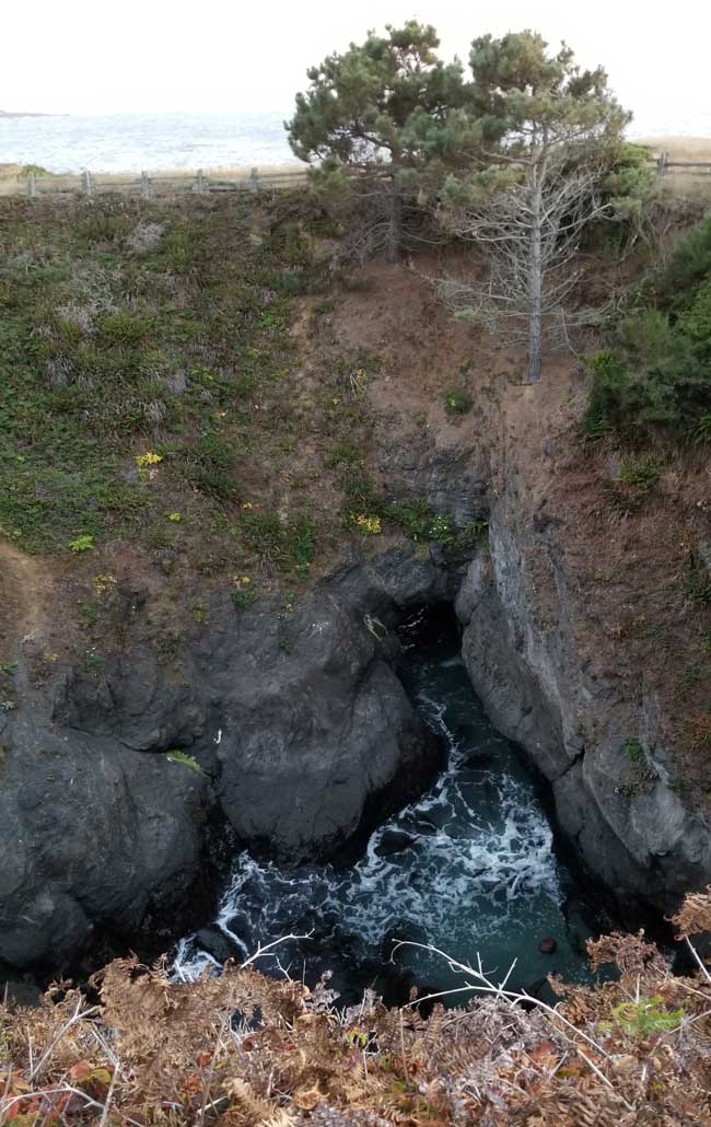
Wendy and I decided to drive to a local park to watch the sunset. In the parking lot there was a sign showing the way to the “Sin Hole” which sounded like an odd name for a feature. We followed the trail and when we were almost to the cliff edge we found a large depression going clear down to the sea where we realized that what we were looking at was acually a”Sink Hole.” Some wags with a scraper completely tricked us. The sunset was beautiful and it was a great way to end the day.

Sink Hole

Sunset in Mendicino

Sunset in Mendicino

Friday, August 3 – Mendocino

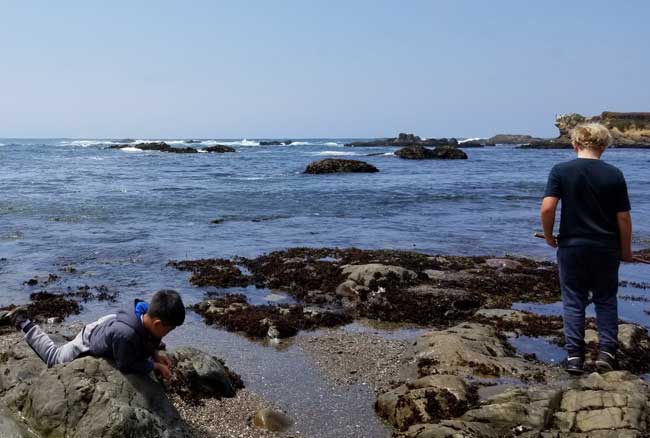
Today we went out for breakfast/lunch at a restaurant the kids liked. Some of us had breakfast and some chose lunch. We all felt stuffed by the time we left. Wendy, Wyatt, Augie, and I went to a beach called Sea Glass Beach. The story goes that there was a dump nearby for some time and bottles eventually escaped and were battered into tiny shards by the sea and then onto the beach. Subsequent wear and tear made them smoothe-edged and buffed. Anyway, every handful of sand contains lots of polished sea glass that glints in the sun. When we were there today there were also lots of little tide pools with hermit crabs, seaweed, snails and small fish. There were two little girls capturing creatures and setting them free in the ocean. They were so excited and every find was a thrill. Wendy found and caught a little hermit crab too. The beach had lots of big rocks to sit on and crawl on and the water sprayed up as it came in.

Teeny Hermit Crab

Tide Pool

While we were at the beach Butch and Zach took our car to the Chrystler dealer in Fort Bragg to check out an engine light that had come on. Before we started on this trip we had the oil changed, got new tires, and had the brakes checked. We only have a few miles over 60,000 so we figured it was good to go on such a long drive. Somewhere in Nebraska the “check engine” light came on. We checked all the obvious things, temps, pressures, coolant etc.  At the Mendocino dealership they hooked it up to their computer thingy and couldn’t find a problem. The guy who was their expert reader of this gizmo would not be in until Tuesday. No good for us because we will be on the way home by then. They surmised it might just be a faulty sensor. Anyway, they reset the sensor and if it comes on again we’ll see about the problem in another town. Fingers crossed.

House of Jessica Fletcher from Murder She Wrote

We also took a short tour of the villiage of Mendocino. It is small and charming. The TV program Murder She Wrote was actually filmed in Mendicino, not Cabot Cove in New England and we had a chance to drive by the house where Jessica Fletcher was supposed to have lived.

Mendicino

We also rode through the State  forest then came home for a rest. Dinner tonight was grilling. Orange pork chops, jicama salad, and corn on the cob was on the menu.

Saturday, August 4 – Mendocino to El Cerrito

We spent the morning cleaning up Erin and Bryan’s house. We washed and changed the sheets and made sure everything was shipshape for the next visitors. Other friends  were coming to stay in a week or so. We got away by about 12:30 which is pretty good for this group.

The ride back to El Cerrito was largely uneventful. The first half is on a twisty stretch through redwood forest. The woods are deep and dark and spooky. While they don’t seem at all sinister they are intimidating because of the grandeur of those trees. It reminded me of the Hobbits traveling with Gandalf through the Mirkwood Forest.

We saw a couple of tent camping sites which would be really cool with those towering trees, ferns, and fallen logs the size of water tower tanks.

The only thing of note other than that was we stopped at least 3 times for bathroom breaks. The kids were drinking lots of fluids and couldn’t get in synch.

For dinner we went to Tacubaya, a Mexican restaurant that was pretty good. It was very busy and was a counter ordering place and they later delivered to our table.


Posted in Autobiography, Daily life | 4 Comments

2018 California Vacation – Part 2

Friday, July 27 – Vernal, CO to Salt Lake City, UT

Since our drive to Salt Lake City would be relatively short, we decided to take it easy and have a relaxed start to the day. When every day is full of traveling and activities it can be hard on retired people who normally have a slow paced life. We don’t want our vacation to turn into a big burden.

When we left Vernal the scenery was very beautiful just as it has been every day. At first there were cliffs and canyons with layers of red, gold and light colored rocks. There were also some of those eroded stacked formations in interesting shapes. We did a lot of climbing and descending and also drove along some relatively flat terrain. As we got closer to Salt Lake City we saw several very large reservoirs which seemed a little out of place amidst such dry vegetation. We really love seeing how beautiful our country is. It is so hard to describe the vastness, the diversity, and the awesome beauty in words.

We spent a lot of our driving on interstates today and it is clear why we don’t normally plan our route through big cities. The traffic in the metropolitan Salt Lake City area was brutal and of course this is construction season. I think the lanes out here are narrower than at home. It certainly seems that way when a big truck is barreling along beside us on one side while on the other is a steep drop or a construction barrier…all at 75mph around winding curves! Butch got us through like a champ. I am no good at this kind of driving.

Antelope Island UT

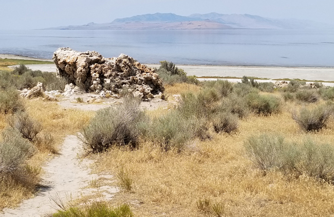
Our main destination today was Antelope Island State Park. Travel sights on the internet said it was the best place to look at the lake since the water level is so low in the summer. It is the largest of 3 islands in the Great Salt Lake and is a wildlife haven. It is named for the pronghorn which has a good sized population on the island. There are also bison, deer, bighorn sheep and coyotes along with many small mammals and lizards. The “keystone species,” a term I learned today, are brine shrimp and brine flies that are found in high concentrations and provide a rich diet for birds, small mammals, and lizards. This allows for the diversity of animals to live on a relatively small island. We did see a herd of bison off in the distance, but not close enough to get a really good look. We also saw  lots of birds, and lizards and we were glad we came.

Many people come to hike and there are lots of nice trails. The two of us are not much for strenuous hikes especially in the heat. Today’s high temperature was 104…but of course it is a dry heat! We confined ourselves to scenic overlooks, the visitor center and photo opportunities.

Birdhouse at the Visitor Center at Antelope Island

Antelope Island UT

Tonight we went to a Mexican restaurant called Red Iguana. It is highly rated and has a “must try” recommendation. We really enjoyed their interesting menu. I had mango enchiladas which were outstanding.

Red Iguana

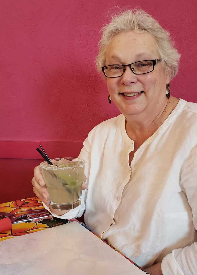
Karen with a tasty Marg

Karen’s Mango Enchiladas at the Red Iquana 2

Butch had a delicious marinated pork dish but when he took a picture it looked like a cow pie so he decided not to post it!

Saturday, July 28 – Salt Lake City, UT to Great Basin National Park and Ely, NV

Today’s drive was a long one. Not far outside of Salt Lake City, we could now see salt deposits along the roadway. The sky was very hazy with almost a blue cast. At breakfast we saw a newscast saying that visibility was poor because of a number of fires in the area. We looked at a Nevada fire map and saw nothing along our route. Any fires were to the north with a couple small ones in the south. It really did not seem like smoke and we couldn’t smell anything but I’m sure they knew what they were talking about.

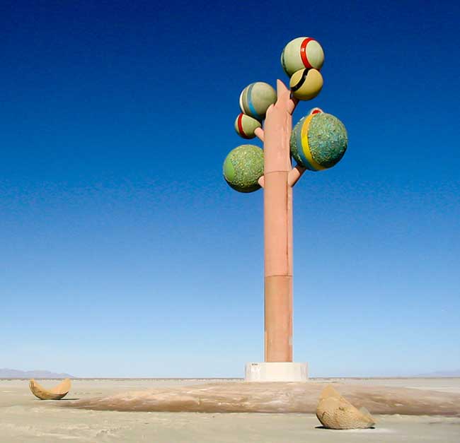
The salt flats looked very white and smooth. Near the road, people had stopped and made messages and pictures in the salt with stones. There were also some sculptures beside the road. One was the head, fins, and tail of a shark sticking out of the salt. Another was like a little Loch Ness monster swimming through the salt. We saw a big sculpture called Monolith: Tree of Utah.

Monolith – Tree of Utah

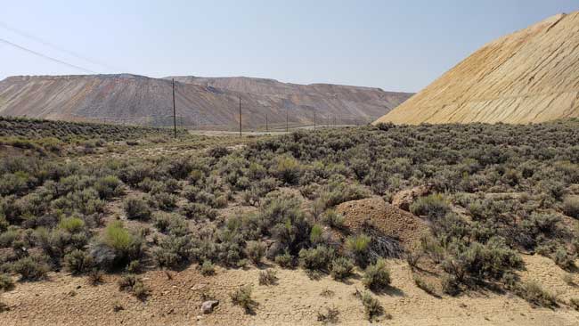
We turned off the interstate and traveled on a two lane and road that seemed like it was in the middle of nowhere. We drove for at least 100 miles without seeing a town or seldom even a house or farm building.Otherwise we spent a very long time driving through a desert landscape covered in scrubby plants and tumble weeds. I have to say that of all the miles we have traveled, this was the least appealing.

Nevada Scenery

Nevada Scenery

When we got to Ely we drove by our hotel and the depot for the train ride we will go on tomorrow. It was too early to check in so we the went to the Great Basin National Park Visitor Center. The displays were interesting and help us understand more about this huge chunk of land that covers most of Nevada. Unfortunately, I was not feeling very well so we skipped the drive to Wheeler Peak and headed back to Ely. We think we are suffering from a little dehydration and altitude sickness. It’s not too bad but it takes the joy out of things.

At one point we passed a wind farm. There were several rows of windmills. Quite a number when you added them all up’

Wind Farm

When we went to France a couple of years ago, I took a couple of pictures of people we ran into, almost by chance. They were some of the favorite pictures we took. I decided that I should take people on future vactions. Here is a picture of our waitress at Rack’s Bar and Grill when we had supper that night.

Waitress at Racks Bar & Grill

Our hotel here is the worst we have been in. The room itself is clean but most everything else is very old and barely working. The handle on the door is loose so it is hard to make the key work. There were 2 hand towels and 2 washcloths and no bath towels. We decided washing up would be good enough because who knew how the shower would work. Worst of all, the air conditioner could not cool the room. It was in the 80’s when we went to bed and it didn’t really cool down until about 3:30 when it was 50 degrees outside.

Sunday, July 29 – Ely, NV to Lee Vining, CA

We had a difficult night in our motel. The air conditioner was bad and neither of us slept well. On top of that we set an alarm for morning because we had booked a steam train ride for the morning. Instead of waking us at 6:30 Pacific time it woke us at 6:30 Mountain time which was an hour earlier. We were up and almost ready an hour earlier than we had planned. The good news is we had plenty of time for breakfast and packing up the car.

Ely, Nevada, Train Depot

The train ride was called the Nevada Northern.

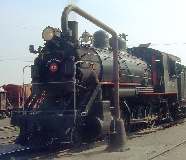
Steam Train in Ely, NV

They had an old refurbished steam engine and 1860’s vintage passenger cars. They also had an old flatbed car with benches for those who wanted take pictures. We put on our sun hats and sat outside since it was only in the low 80’s as we started.

As we waited, a soot covered fireman walked by and I asked to to take his picture too.

Fireman on the Steam Train

Karen and Butch on the Steamtrain RideA real steam engine has a lot of black smoke which falls on the viewing car in the form of soot and tiny cinders. We were soon covered but we didn’t mind.

The ride is about 5 miles out and then the same back.  There were two tunnels.

Entering a Tunnel

They also had a cheesy train robbery and shoot out at a ghost town at the halfway point.

Fake Frontier Town with Train Robbers

The ghost town was right next to a gigantic open pit copper mine. They piled the tailings so high around it that you couldn’t actually see the mine itself. But you could see the results of their labors.

Copper Mine Tailings

On the way out we were steadily climbing so that was slower than the way back. The train actually backed into a siding and when they switched tracks we came back with a new view out our side. There were lots of road crossings so lots of steam horn blasts. We both had a great time and Butch got some good pictures.

After gassing up we headed out to Lee Vining, CA which is just outside the east gate into Yosemite. We had hoped to meet up with Wendy, Zach, and the boys on the other side of the park on Monday but as I said earlier, the Ferguson Fire caused the evacuation of Yosemite Valley so we decided as a group to switch gears. We still traveled to the east entrance but planned to go north from there on Monday, around the park and on to the Bay Area.

The drive to Lee Vining was spectacular.  We drove the rest of the way across Nevada through grey green scrub without seeing more than 10 buildings the whole way. The road was straight as an arrow most of the time and you could see miles in every direction. The sky remained hazy and smoky all the way. As we drove along we saw a tall tower that was too far away to make out clearly, but the top of it glowed brightly. Hmmmm? We came to a rest stop and while there we saw a number of Joshua Trees which were previously unknown to us. We looked them up in Google Images and took this picture of one. I noticed that the glowing tower was just next to the tree, off to the right a little, just above the horizon. Later I looked the area up on Google maps and discovered that the light was part of the Crescent Dunes Solar Energy Project.

Joshua Tree with Solar Farm in the Background

Soon after the California border we turned off on highway 395. The road was smooth and looked like new but it twisted and turned and had hills like a roller coaster. For most of the 60 miles we drove 45 mph or less. Right away the roadsides looked greener and had different plants that had small yellow flowers and bright green foliage. As we climbed there were beautiful rounded dark tan boulders that looked like balls of clay all smooshed together.

California Mountains

The scenery and views were stunning but due to the twisty up and down road there were no overlooks for pictures. It was much too treacherous to pull over.

Lee Vining is a park town with hotels and a couple of restaurants. We checked in…nice room this time…no complaints.

Whoa Nellie Deli

After settling in we went to the Whoa Nellie Deli for dinner. It was a rockin’ place with hundreds of tourists sitting at picnic tables, a live band, and kids running everywhere.

Dinner at the Whoa Nellie Deli

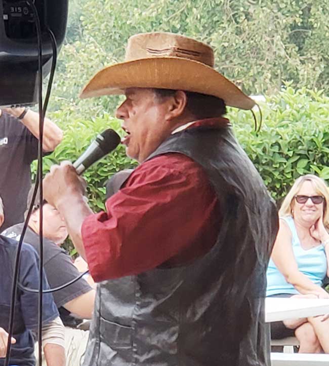
The band was playing all 60’s and 70’s music and lots of white haired oldsters were out dancing and grooving to the music. They trotted out one of the wait staff who did a rocking version of La Bamba.

Outdoor Entertainment – La Bamba

They also had a gas station and we payed over $4.60 a gallon for gas but we are ready to take off tomorrow.

Monday, July 30 – Lee Vining, CA – El Cerrito, CA

We got up leisurely and decided to take a little trip to see Mono Lake after our waffle breakfast at the Epic Restaurant next door. We went to the Mono Lake visitor center only to find out that it was so smoky you could barely see the shoreline. We started on the route across the park on highway 120. We were so glad we did.

We drove to the ranger station then up into the mountains on Tioga Road. The Tioga Pass is the highest elevation on the road at about 10,000 feet but other mountains towered above us. The views were undisturbed by smoke the farther we went up. I got out of the car several times at overlooks and sidled over as close to the 2 ft. barrier wall as my height phobic mind could bear. I got some great pictures. Every time I got out of the car , the air was filled with the fantastic spicy smell of the plants by the side of the road. I wish I knew what they were. We were worried that we would miss all the beautiful sights in the valley but there were many other fantastic beauties on our route.

First came an area called Tuoloumne Meadows. It was a series of high meadows with a bubbling creek down the middle, sometimes with marshy areas and all the shades of green and gold grasses in the world. It was also dotted with tiny mountain flowers and big glacier boulders dropped there who knows when.

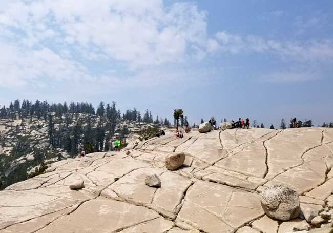
Next stop was Olmstead Point. They had one of those information plaques the showed the peaks in the distance all labeled with their names. The big peaks were visible through the haze but on one end it identified Half Dome which was now totally invisible because of the smoke. At that overlook there were other smaller domes which seemed to be made up of white sparkly granite smoothed by weather and time.

Cracked Rocks in Yosemite

We traveled on along a twisty road, mostly down. Sometimes it was lined with redwoods and sometimes regular pines. There were awesome pine cones from the redwoods lying on the ground. Some were as big a small melons. I dearly wanted to pick one up to bring home but I was sure it was not allowed. I do believe in “Take only pictures…” in our precious parks.

At one point there were clouds of back shapes that seemed to be fluttering all around us. I thought at first they were ashes from the fire which was alarming but it turned out to be butterflies which were hitting the car. I looked them up and found they were Field Crescent Butterflies and we were in the middle of the their main emergence. I hated seeing so many of them hit the cars but apparently that is an unfortunate “thing” for them.

Yosemite

We also went by beautiful lakes with sandy beaches at the edge. Lots of tourists were paddling around in the water. I figured they were probably European because all of the guys were wearing speedos! It was an awesome drive and we were so grateful that we were advised to go that way.

As we got lower and lower in elevation, the smoke began to get thicker. We noticed a little stinging in our eyes but that was all.

Smoke in Yosemite

Smoke in Yosemite

As we left the park we saw lots of heavy firefighting equipment and firefighters standing by. I sincerely hope fire does not actually touch this treasure. Just outside we got on another twisty road that was scarier than any road we were on in the park. It was one of those roads that cling to the side of the mountain and as you drive you can see new twists and turns that are coming up below you. They had enormous road signs at every curve announcing 20mph that let you know they were not kidding.

Luckily it smoothed out in Moccasin and we drove toward El Cerrito on the flat. On that road we passed lots of fruit and almond groves along with fruit and nut stands. Soon we were on the Interstate and drove in thick rush hour traffic the rest of the way. At last we arrived and spent a great evening chatting and catching up with the family.


Posted in Autobiography, Daily life | 6 Comments

2018 California Vacation – Part 1

Calfornia or Bust – 2018 Driving Vacation

We usually travel to California by air but this year decided to plan an epic driving vacation to see all of the sights between Iowa and California that we could possibly pack in. In the last several years we had traveled to Yellowstone via the Black Hills and seen a big chunk of the western landscape. Last fall we planned a trip to the Grand Canyon and parts of the southwestern states on the spur of the moment. This time we hoped to see some of the places we had missed on those two trips. A highlight would be meeting up with Wendy and her family at Yosemite National Park, definitely a site on our bucket list with the added bonus of enjoying it with the Copleys. Unfortunately for that last part, the California Ferguson wildfire was threatening Yosemite and ultimately the park was evacuated. Before that even happened we decided to cancel our reservation there. Still on the bucket list but maybe another time.

2018 California Vacation Route Plan

While looking forward to a vacation is always exciting, this time we had some worries about a car trip of such a length. We shall see how our rather creeky joints will weather  a car journey. Onward!

Monday, July 23 – Heading to Grand Island, NE

Ready to Take Off

We got the car packed and left Cedar Rapids at about 9:30am. We knew that today  was going to be one of the longest and most uneventful drives of the trip. We started our first audio book, “Scandal in Skibbereen” by Sheila Connelly. We had listened to her first book in the series on our Grand Canyon trip last year. It was a great way to pass the time and we didn’t stop for a break until we crossed the Missouri into Nebraska. We arrived in Grand Island and checked into our hotel at about 5:00pm.

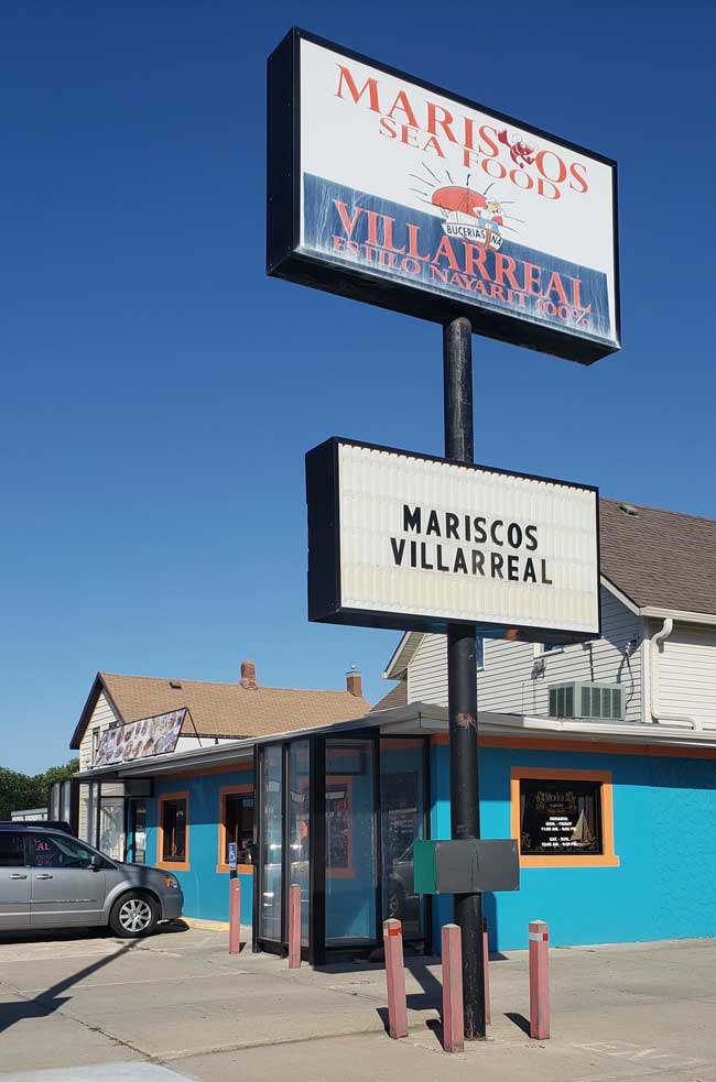
Maliscos Villarreal Restaurant

We chose a Hispanic restaurant specializing in seafood that got good online reviews. It turned out to be an adventure because the menu was all in Spanish and the waiter didn’t speak much English. We got the job done and we both enjoyed our dinner.

When got back to the hotel we had a FaceTime session with Ben. Butch had sent him a map with all our stops and our itinerary of activities and attractions so he could keep track of our travels. In spite of a so-so connection we had a good chat. The rest of the evening was spent with catching up on our journal and relaxing.

Tuesday, July 24 – Grand Island to Scott’s Bluff, NE

After a hearty hotel breakfast buffet, we got an early start for Scottsbluff. Before our trip, our friend Patti, who grew up there, gave us some great advice about sights to take in so we had a plan for the places we wanted to see. From the beginning we had decided that we would not plan a strict interstate route. Even though we have a lot of ground to cover our purpose is seeing the country. We traveled across Nebraska first along Hwy 30 and then on other state highways that would take us north to Scottsbluff. We ended up driving the scenic byway through Sandhill country. It is best known for the gathering of Sandhill Cranes in the springtime. It seems that up to 500,000 cranes stop off in this area to feed and fatten up. That, of course, was not going on as we passed through.

Nebraska Sand Hills

However, the hills were unlike anything we had seen before and were quite beautiful. They are low with soft rolling folds, some with distinct peaks, and others that formed long ridges. They were covered in soft green grass with just a few trees. Bare spots reveal light sandy gravel sized rocks and soil. They look a lot like dessert or beach dunes except they are green. They are dotted with lots of small lakes and marshy areas which may also be attractive to the cranes.

Early settlers traveling to Oregon or California  considered Scottsbluff as the end of the prairies and the start of the hard mountainous journey ahead.

Chimney Rock

Scott’s Bluff

A lot of the sights we visited had to do wth pioneer landmarks like Chimney Rock, pioneer graves, and the Scottsbluff National Monument. At the latter, we drove the twisty road to the top of the bluff to enjoy the view and then checked out the visitor center for exhibits and a short movie.

It turns out we are not so good at picking restaurants and tonight we had a mediocre but expensive dinner before heading to our hotel. Resting up for tomorrow is our goal.

Wednesday, July 25 – Cheyenne’s Frontier Days Rodeo!

We set an alarm for this morning which rankled but we wanted an early start to get to the rodeo at Cheyenne’s Frontier Days.The motel we stayed at had a deal with a little diner that was right next door. We went there for breakfast which was ok but not great. I include this picture for all middle century boomers who almost certainly remember formica counter and tabletops with the distinctive pink and gray boomerang pattern.

Boomerang Formica

On the way into the diner we saw a really strange racing boat. It was still there when we came out and I took a picture of it. The guys with the boat were just coming out and I asked one of them how fast it went. He said 210 miles per hour, but you couldn’t do it in the ocean, it had to be run on a calm lake. This was in the morning and he said they had to be in Washington State the next day. We were in western Nebraska. Good gravy.

Racing Speed Boat

We had looked at the forecast for today and saw there was an 80% chance of rain. There was a Dollar General near our hotel so we zipped in to buy some ponchos before we got on the road.

Our route was again on two lane roads and we enjoyed the beautiful scenery along the route. We had a long stretch of prairie again and then started to climb into foothills. The road wound between hills and rocky formations but was smooth and we made good time. We continued to listen to our audio book and finished it up.

We had decided to park in the shuttle lot on the advice of the ticket agent who sold us our admission. Since got an early start we got on a shuttle bus and arrived at the Frontier Days grounds. Everyone we met was super nice and helped us arrange a golf cart ride from the gate and a scooter ride up the ramp to the top of the arena. Our seats were in a shady covered section overlooking the bull and horse pens and the chutes for the riders. Unfortunately they were in the very topmost row so we had a long trek up scary steps to get there.

Neither of us had ever been to a rodeo and it was so much fun. There was a great opening ceremony with galloping horses and fancy riding. Right at the end they drove in about 20 horses that ran full speed around the arena. It was rather thrilling. Since our seats overlooked the chutes, we had a great view of the riders and crew getting ready and coming out.

Broncs and Bulls Waiting to Compete at the Rodeo

We saw bare bronc riding, cattle throwing, bull riding, junior bull riding and cattle tying. It was all totally amazing and it is a wonder those young men can walk normally. It is certainly a punishing sport. Apparently it is well paid for those who consistently win. They had some world champion riders who had earned in the millions over their careers.

Butch took some wonderful action photos of the events. I tried to take some and was so slow that I missed their whole ride so I decided to watch and enjoy. Plus I get to look at his pictures.

Bull Riding

Bull Riding

When we left the rodeo grounds we drove to Walton, CO for the night. Frontier Days is such a big deal that we couldn’t find any hotel near Cheyenne. We ended up driving 116 miles to find a place to stay. We ate buffalo burgers and had some beers at the Moose Creek Cafe before going back to our hotel for the night. What a wonderful day.

Butch with a Stella Artois

Thursday, July 26 – Dinosaur National Monument

We had breakfast in the same place we ate dinner last night. That was the first dinner we had that was acceptable. Why mess with a sure thing?…and breakfast is a meal lots of places can get right. We do not have particularly good luck picking restaurants while on vacation. The available fare is usually burgers, sandwiches, or “country style” places often described as American Comfort Food, with less than tasty or fresh offerings. We are hopeful we can fine a nice restaurant in Salt Lake City.

Anyway, we got away and again drove two lane highways heading toward Dinosaur National Monument. The terrain changed dramatically as we traveled along. Green, tree covered mountains, high passes looking down onto lakes, a 7 mile descent with edges that went straight down, and then arid rocky landscapes as we drove into Utah. Today’s drive was about 4 hours which is our favorite distance, though actually the sights we want to see determine how far we go. We are good for about one attraction per day for the most part. That counts for driving, seeing the attraction, then driving the rest of the way to our night’s stop.

The monument has a couple of parts and the most famous and accessible is the Dinosaur Quarry Exhibit Hall. The site was first discovered just after 1900 and has yielded an incredible assortment of complete fossils and individual bones. The exhibit building was built around a massive wall of fossil bones that have been revealed and prepared by scientists. It is still being worked on and new discoveries of skeletons are still being made. Chances are, if you have ever visited a major museum that has dinosaur bones, some of them have come from this site. There is a long ramp that leads to a viewing balcony and on the ground floor you are allowed to touch the fossil bones still in the rock wall. They think that when the dinosaurs that contributed the fossils died, it was a particularly dry period. Something, a flash flood perhaps, killed many dinosaurs in the dry riverbed. That flood or a later one pickup up the carcasses and wash them down stream where they were stopped, lika a fossil log jam.

Dinosaur Bones in the Cliff Face

Stegasaurus

Allosaurus Skeleton

The hall was air conditioned but the day was very hot and our car thermometer said 101 as we left.

Finally, we hit the dinner jackpot tonight. We went to The Vernal Brewing Company in Vernal, Utah. They are a micro brewery and served delicious food. I had red trout from Idaho and Butch had chicken skillet pie. Both were delicious and made from real, fresh ingredients.

Skillet Chicken Pie at the Vernal Brewing Co.


Posted in Autobiography, Family | 3 Comments

1956 – The Family Car Recess Problem

In about second grade we had recess a couple of times a day. When the weather was good, we went outside to play. I think that we went out and played even when the weather wasn’t good too. I don’t know what the teacher was up too, but on occasion, she would phase our dismissal to the playground. I asked Karen about this and she said the teacher was probably trying to impose a little order on an otherwise raucous event.

So we all were sitting there, anxious to get outside and she said, “How many of your parents have a Chevy?” You can imagine that quite a few kids raised their hands. She let them go outside. Next, she asked how many had Fords. Another big group headed for the door. Now the whole business got trickier. She ran through Plymouth, Dodge, Pontiac, Buick, Oldsmobile, Mercury and many others, maybe even a DeSoto, Hudson or Nash. Most times, she would send another student or 2 on their way. As she went on, the group that remained got smaller and smaller? Finally, it was just me. She kept naming cars and I knew she would never guess mine. She said, “OK, what kind of car do you have?” I said, “Studebaker!” She said, “I never would have guessed that!”

The Thorpe family about 1955 with their Studebaker Champion.

Posted in Autobiography | 2 Comments

2002 – The Mystery of White House Farm.

I went to England in 2002 to visit my aunts, uncles, and cousins and to do as much genealogical research as time permitted. Before I left, my mother told me that my uncle, John Bellamy, had a small painting that was supposed to be a picture of the house where my grandmother, Grace Carolyn Thorogood Bellamy or her mother, my great grandma, Emily Munson Thorogood was born in. I asked my uncle to see it when I got there and since I showed an interest in it, he left it to me when he died.

White House Farm ?

I didn’t have a lot to go on at the time. I was pretty sure that my grandma was born at 37 Baddow Rd in Chelmsford. It was a row house, so probably the free standing building in the painting was not where she was born. That left it as the possible birth place of her mother, Emily, who was born in Felsted. When I went there I made an effort to find the house, but so many of the houses were like the one in the picture that it could have been any of them? I continued my research after I got home and eventually discovered the place where Emily was born was called Rose Cottage.

In time I got a drawing of it done by a Munson descendent and some actual photos taken by another Munson descendent.

Rose Cottage 1944

In both the drawing and the photos, the doorway exactly matched the doorway in 3 different photos of Emily’s mother, Mary Ann Munson. Curious!

Mary Ann Munson at Rose Cottage

So the painting isn’t either Grace or Emily’s birthplace. Whose was it?

I noticed that in 1891, Frederick Thorogood, his wife Emily and his mother Mary lived in a place on Baddow Road in Chelmsford called White House farm. Their daughter Annie wasn’t born yet. She was born in 1891 so it must have been very close to the time the Census was taken.

Add to that the fact that my Grandad was married to Annie first and that he didn’t marry my grandma until after Annie died. We always thought the picture came into the family by way of my Grandma. But it now seems more likely that Annie was the one to have brought it. She was the one who was likely born at the farm.

Annie and James A Bellamy – World War I

If you compare the painting and the map below you will notice a couple of things. The House is basically rectangular with a “bumped out” front entry. It looks like it has a couple of chimneys and it has the fence in front of it. Both the painting and the map are alike on these points. I have tried to find a photo of the farm, but no luck yet. For now, we may have solved the mystery, but we won’t know for sure until we can find a photo of White House Farm.
Whitehouse Farm Map


Posted in Autobiography, Genealogy | Leave a comment

1963 – Homemade Skateboard

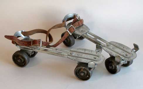
Hard on the heels of the surfing craze of the 1960s, skateboards started showing up. I think there may have been commercially made boards, maybe in California. In Iowa you couldn’t get them. If you wanted a skateboard, you had to make it yourself. So I grabbed myself a 1 x 6 a couple of feet long and an old steel sidewalk skate, the kind that used skate keys.

Old steel roller skates


I cut the board in the shape of a surfboard, shellacked it, and adorned it with black racing stripes and an Iron Cross. I had to take the skate apart, then I screwed it to the bottom of the board. The skates were steel and didn’t have the best bearings to begin with. The wheels were only about 1/2” thick and the track of the entire skate couldn’t have been more than about 3 inches. Not a very stable platform. The skateboard below looks almost exactly like the one I made, but it doesn’t have the racing stripes, etc.

Vintage 1960s homemade skateboard

Equipped with my new board I skated down the driveway learning the basics of starting, turning, and dismounting. Only problem, our drive was only about 20 feet long before it emptied onto a pea gravel apron, guaranteed to stop a skateboarder on a dime. I even got so I could hang 10, hanging all my toes over the front of the board.

So, once I had my technique down I was intent to try it out on a big hill. Just such a hill was one block away on Shaeffer Drive. It had a steep beginning, then it sort of leveled out for a nice run, then got real steep again for an exciting finish.

Outfitted in my cutoff shorts and bare feet I headed for the hill. Pushing off, I started to pick up speed and was sailing along nicely. Reaching the flatter section I had some fun coasting along, slowing down a little. I got to the really steep part and started to pick up speed again. As I got going faster and faster I noticed the board was becoming less stable. Soon the sloppy tolerances in the wheels made them wobble a little. With greater and greater speed, that little wobble started to become more pronounced and eventually evolved into a nearly uncontrollable fishtail effect.

At this point, I started questioning the wisdom of undertaking this adventure almost naked with only a pair of cutoffs between my skin and the cruelly abrasive pavement that whizzed by at an ever increasing rate. I couldn’t jump off, I didn’t have any shoes on and that would have resulted in the mother of all stubbed toes. To continue meant that I would be going even faster. I began to feverishly search for a grassy stretch and found one a lot or two further down the hill. Just as the board was about to self-destruct I steered it into the curb and jumped just as it struck. I must’ve rolled and escaped unscathed. It’s funny how you retain little or no memory of an actual incident. I know I didn’t try that kind of stuff again without being fully clothed with a good pair of shoes. And not on that hill either.
Me skateboarding in 1977. Quite a few years later.

Posted in Autobiography | 1 Comment

Deer Update – Christmastide 2017

The other day we had 9 deer in the yard. They were actually running around. Normally they just mosey around slowly. As they passed I counted them and when they were done it came to 9. That is an all time high for us.

A deer staring in the window.

But on a sad note, about a week ago we found a doe dead in the front yard. Most of the deer lay around just outside our kitchen window. Sometimes they gather down by my workshop, but they don’t often stay in the front yard. I thought I saw one out our bedroom window. It is hard to tell because they are almost the exact same color as the fallen logs that are out there. A few days later I noticed some “red” on the log and I began to suspect it was a dead deer. I got the binoculars so I could see it clearer and sure enough it was one of our girls.

I called the animal control office and asked if they could pick it up. They said they couldn’t but if I were to call street maintenance they could handle it. They alerted me that it couldn’t be in the yard and that I should drag it out to the curb. When I got back from running an errand I got out of the car and started dragging the carcass. I suppose my lack of physical fitness was my major problem. Anyway, I was not that excited to touch the body because I suspected it had been dead long enough that the body could have begun to deteriorate. Such was not the case however and while there was a little rigor mortis, it held together completely. I could get a good grip with my right hand but I thought I should pull with my left hand too. It kept slipping down the leg and I had to readjust my grasp all the time. The fur was nice and dry and was very soft to the touch which I did not expect. I kept running into sticks and undergrowth that blocked my way. I kept at it but ended up pulling a muscle in my chest. It turned out to be much harder than I imagined.

I got it into the street and came in the house to call the Streets Department. They thanked me for calling and said they would have it out of there in less than an hour. Which they did.

Posted in Daily life | Leave a comment

Carol Lynne Thorpe

Seventy years ago today my big sister Carol Lynne Thorpe died.

Carol Lynne Thorpe

I never knew her. She died before I was even conceived. But I can’t help but wonder how the dynamic of our family would have been different with her running point and me sliding into her slipstream as the next in line.

New born. Carol Lynne and Paddy Thorpe

Like me, she lived with our folks, Ray and Paddy Thorpe, in my grandparents’ apartment at 545½ 2nd Street in Webster City after she was born.

Uriah Blake and Carol Lynne Thorpe

She was baptized at the United Brethren Church. There were no Episcopal churches in Webster City at the time. She is wearing the Thorogood baptismal gown. The first grandchild and the first in her generation to do so.

Baptism

My dad was a WWII veteran and attended Iowa State College on the GI Bill. To start out, the family moved to Johnston, Iowa, where Dad took classes at the Camp Dodge campus.

Grandpa and Grandma Sanders with Carol Lynne

They lived with “Grandma and Grandpa Standers” their landlords.

In the summer of 1947 they visited my Dad’s sister and her family, which included their new son, David, who were living in Albuquerque, New Mexico, at the time.

David Lynch with Paddy and Carol Lynne Thorpe

Sandia Crest Monument, Albuquerque NM

In the fall my dad returned to classes at Iowa State, but this time he took those classes on the main campus in Ames. They lived in married student housing in Pammel Court.

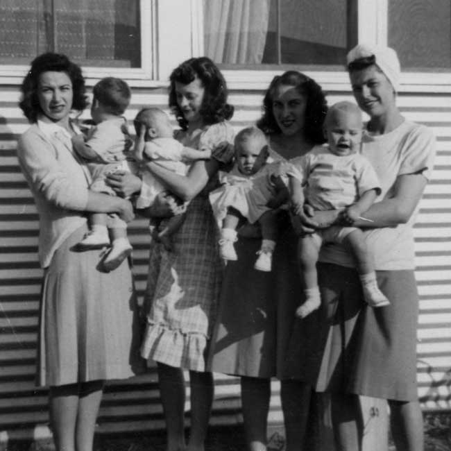
Baby Boomers at Pammel Court, Carol Lynne and Paddy Thorpe, 3rd group from left

There were lots of little Baby Boomers around and Carol Lynne was one of them. My mom worked at the Student Union.

Carol Lynne Thorpe being risque.

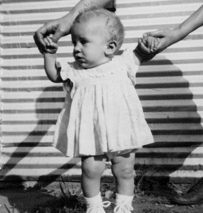
Carol Lynne Thorpe

Lots of drool for Daddie!

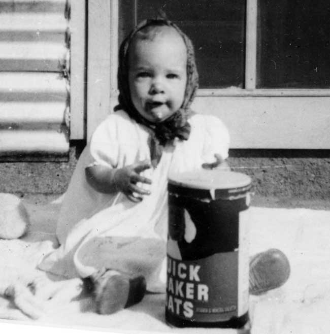
Carol Lynne Thorpe. Give me those good old Quaker Oats.

Sometime in the fall, Carol Lynne got sick and died October 27th. We don’t know exactly what she died of. Who knows? SIDs maybe. But 10 years later my youngest sister Lisa had similar symptoms when she was a little older than Lynne. Her problem turned out to be hypoglycemia, kind of reverse diabetes. Hypoglycemia was not very well known in 1947. It only took a glucose drip to bring Lisa out of her coma. What a shame if it could only have been that easy with Carol Lynne.

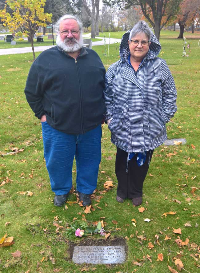
My folks were dirt poor students when they were in Ames. They didn’t even have enough money to get her a grave stone. In 2001 my brother and sisters chipped in and we bought her a modest stone. We drove over to Ames. The cemetery worker had located the grave for me and cleared out a patch the size of the stone. I laid down a bed of sand and placed the stone.

Today, my wife Karen, my sister Lisa and I drove over to Ames again to honor her on the 70th anniversary of her death.

Robert and Lisa Thorpe at Carol Lynne’s grave

We laid a rose on her grave.

Carol Lynne’s grave stone

Posted in Autobiography, Genealogy | 2 Comments