
The flood crested yesterday at 31.1 feet. I was out taking pictures but my camera ran out of batteries before I could finish up. I had borrowed it from my friend, Ernie Rairdin, and had to return it to him to get the batteries charged. As it turns out he was out with his son photographing the flood from an airplane. You’ll see some of the views below. They are just amazing. I went over to his house and borrowed his camera again today but the weather has just turned bad and I think I’m unlikely to get any shots in the rain. I have not yet been across the river to the West side to take any pictures. I-380 is the only route across the Cedar River for miles and miles and miles. To get to Iowa City from here you have to contend with both the Cedar and the Iowa rivers. That means to go those short 30 miles you have to take a 281 mile detour, up to Waterloo, West to I-35, South to Des Moines and then east back to Iowa City. As you can imagine, traffic on the I-380 bridge is bumper-to-bumper practically all the time. So, here are some of the views.
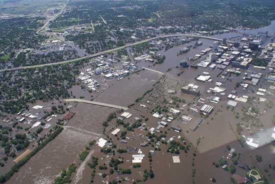
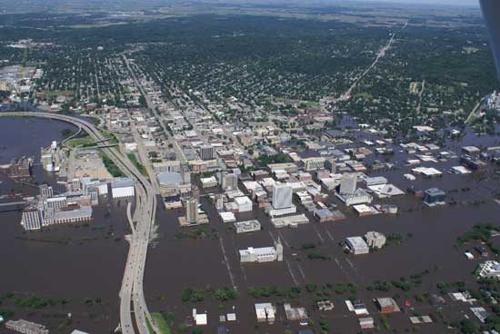
Aerial photos by Ernie Rairdin:

Downtown Cedar Rapids, Iowa, looking north
Downtown Cedar Rapids, Iowa, looking almost due west
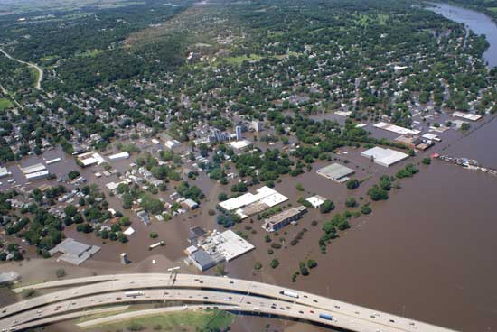
Timecheck neighborhood, Cedar Rapids, Iowa
Downtown Cedar Rapids, Iowa, looking northeast
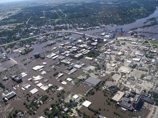
Downtown Cedar Rapids, Iowa, looking west
I had to reduce the pictures for the web. You should see them at full screen.
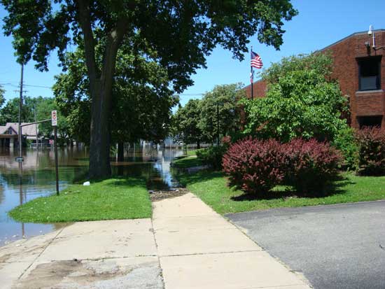
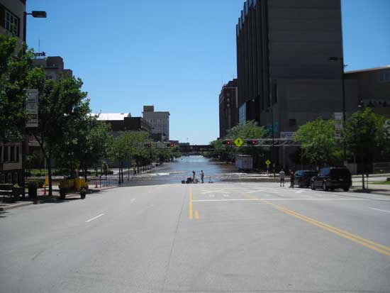
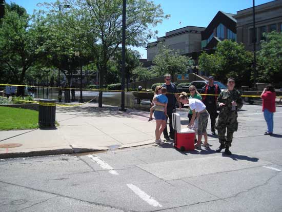
Here are some of my ground-level shots.
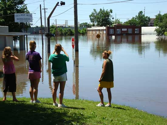
Folk historians documenting the flood of 2008, 12th Ave. SE, eight blocks east of the river
Metro High School, nine blocks east of the river
1st Ave East looking west, four blocks east of the river
The Art Museum, five blocks east of the river
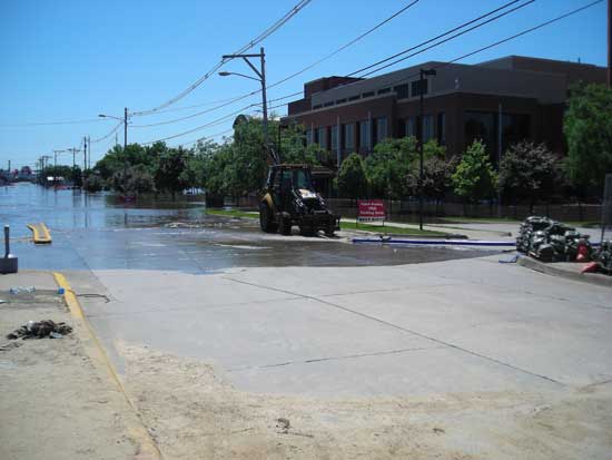
Mercy Hospital, 10 blocks east of the river
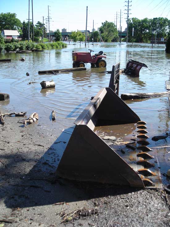
Typical flotsam and jetsom
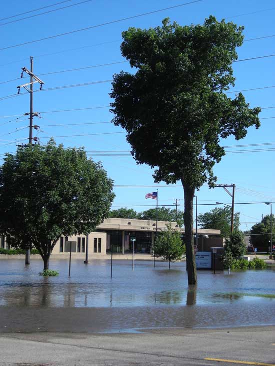
The central post office, eight blocks east of the river
Whatever you do don’t call in FEMA!! At least while Dubya’s boys are in charge!
butch,thanks for the updates.this is truly a tragic event.this is way more than i remember the picturs taken showing Q O andthe rail yards under water.thank God everyone is safe and dry,and God be with all thoughs affected by this tragedy.
dick
These shots are amazing Butch. I keep thinking about the library and science center and Mercy Hospital under water. That Metro high school is just about where I turn to head to your house. It looks like there is just water in front of the Art Museum, but not in it. Our paper says 24,000 out of their homes. Today there was a picture of house that had broken loose and floated up against the second railroad bridge. This is just unbelievable. Glad you are all safe. I saw the note from Joyce. Are her family okay?
The house up against the second railroad bridge is not what it seems. There are a ton of houseboats that broke loose from Ellis Harbor and drifted down to the bridge.
wow–stay high and dry up there!
Craig and Nancy
ps–send us some rain please!
I can’t look away, but it just aches to see the pictures. I’m so glad that you are all safe, but it is easy to see that so many folks will have their lives and homes forever changed by this. Let those of us ex-patriot Cedar Rapidians know how we might help in ways that won’t be skimmed and diminished by our beloved government.